
Good Hope Mine (Mammoth Good Hope Mine; Mammoth-Good Hope Mine; Mammoth Chimney Mine), Vulcan, Vulcan Mining District (Cebolla Mining District; Domingo Mining District), Gunnison County, Colorado, USAi
This page is currently not sponsored. Click here to sponsor this page.



Latitude & Longitude (WGS84):
38° 20' 35'' North , 107° 0' 26'' West
Latitude & Longitude (decimal):
Type:
Köppen climate type:
A former Au-Ag-Te-S-Cu-Zn-Sb-V-Bi-As-Hg-Se mine located 0.6 km (1,900 feet) WSW of the Vulcan townsite and about 14.4 miles S19W from the city of Gunnison (on the divide between Camp Creek and Little Camp Creek, about 700 feet W of the Vulcan Mine), on private and public lands. Discovered in 1894 by J. A. Himebaugh and others (claimants). Property came to be comprised of 9 patented claims and 7 unpatented claims. Operated from 1898 to 1930. Owned and operated by the Diamond C Mining and Milling Co., Gunnison Colorado (1937). Owned by the Herron Mining Co. (1983). Operated by Webbco, Cleveland, Texas. (Vulcan Resources, Inc., El Paso, Texas) (1983). MRDS database accuracy for this location is not stated.
This mine was comprised of the following patented claims: Vulcan (MS 10909), Rose Bud (MS 10910), War Eagle (MS 10910), Humming Bird (MS 10910), Iron Clad (MS 10910), Mammoth Chimney (MS 12454), Good Hope (MS 12456), Humboldt (MS 16392), Mill Site Lode (MS 19920); plus the following unpatented claims: the Wall Street, Camp Bird, Sunny Side, Last Hope, Carberry, Spar, and Little La Veta claims.
The Mammoth Good Hope and Vulcan Mines were the principal mines in the district, having produced from 1898 to 1904, and intermittently through 1930. Sulfur was produced in 1907. A 40-ton matte smelter was operated on site for a while to treat ore. From 1916 to 1926 the Godd Hope Mine was owned by the Good Hope Mining and Reduction Co., whose principal was one Dr. Weiss (presumably for whom the telluride Weissite was named). The Vulcan property was owned by J.H. Himebaugh. In 1928 the Vulcan, Good Hope and other claims were consolidated and operated by Vulcan Consolidated Mines Corp. Last reported production was in 1930, but assessment work was conducted in 1937 by Diamond C Mining and Milling Co, of Gunnison, which firm controlled the property in 1937. In the early 1950's, Newmont Mining conducted Cu-Zn exploration by geophysical surveys and core drilling. In 1962, Osceola Mining Co. staked several claims, but its exploration activities were unknown. In 1974-1975, Noranda Exploration optioned available claims and conducted geologic mapping, VLF-EM and magnetic surveying, and drilled 2 core holes. Beginning in 1983, WEBBCO (Vulcan Resources) began recovery of Au via cyanide heap-leach pad operation. Fairly homogeneous dump ore consisting of very fine-grained auriferous pyrite and containing about 0.1 ounce/ton Au is pelletized, mixed with slaked lime, and leached on asphalt-lined pad, with 65% to 70% recovery.
Mineralization is hosted in mafic intrusive rock, schist and felsic volcanic rock (Dubois Greenstone [felsite and felsite porphyry]; quartz vein). The ore body is 7.62 meters thick. Controls for ore emplacement included massive sulfide deposition controlled by the original depositional environment in a submarine volcanic sequence. Precious metals and tellurides localized in a silica vein system near the hanging wall of the lens (Stratigraphic / tructural discontinuity). Native S/Se localized in the oxidized portion of the sulfide lens above the present water table. Local alteration included the oxidation of pyrite to Fe oxides and native S; sericitization and chloritization of schist near the Mineralized zone; supergene alteration of Cu sulfide to covellite; supergene alteration of tellurides to native Te and Cu tellurides (Rickardite, Weissite, Vulcanite).
Associated rock types include Late Cambrian/Neoproterozoic carbonatite; Tolvar Peak granite; quartz veins; and andesite. Local rocks include felsic and hornblendic gneisses, either separate or interlayered.
Also described as a chimney, the Mammoth Good Hope/Vulcan deposit is a quartz vein trending N87W, 85NE and approximately parallel to the foliation of the enclosing quartz-chlorite and quartz-sericite schist (in felsite unit of the Dubois greenstone). The vein replaces schist and ore grades into schist without a sharp contact. At a depth of about 100 feet in the Sulphur shaft is a 12 to 20 foot thick native sulfur zone that grades downward into loose "quicksand" iron pyrite, then into solid pyrite. Formation of native sulfur may have resulted from the downward desulfurization or oxidation of pyrite or by precipitation from ascending sulfurated hydrogen gases.
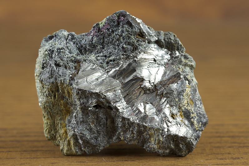
Mineralization: (1) Stratiform massive sulfide lens; (2) Au-, Ag-, and Cu-telluride bearing cryptocrystalline silica vein system confined primarily to the hanging wall of the sulfide lens; (3) native S/Se lens above the present water table. The massive sulfide lens trends E-W, dips 80 to 90N, and is about 700 feet long (along strike, 500 feet deep, and averages 15 feet thick. It consists of a stratiform zone of banded, recrystallized, coarse-grained pyrite, sphalerite, and chalcopyrite, with variable amounts of quartz and sericite. The lens pinches out downward into low-sulfide pyritic sericitic schist. Petzite and sylvanite occur as disseminated grains in the zone of cryptocrystalline silica (chalcedony and opal) in quartz-sericite schist in the hanging wall of the massive sulfide lens. Chalcedony veinlets also were observed cutting S/SE lens and overlying gossan. Veinlets also contain native Te crystals, tellurite, coloradoite, tetradymite (?), and rare Cu tellurides (rickardite, weissite, and vulcanite). The veinlets are unmetamorphosed and show delicate replacement textures. A horizontal, rod-shaped lens of native sulfur, containing native selenium, and measuring 600 feet long, 20 feet thick, and 20 to 30 feet wide, occurs in the oxidized zone, above sulfides, and above the water table. Below the water table, silica matrix has been leached to form a zone of loose, flowing, sand-like pyrite. This lens averages 78% S and 0.59% Se, with sub-lenses containing up to 17% Se. The gossan cap developed from the top of the lens to surface. The deposit was originally believed to be a vein and chimey deposit, with native S resulting either by downward de-sulfurization or oxidation of pyrite, or by precipitation from late-stage, ascending, sulfurated hydrogen gases. A newer interpretation of sulfides in the Gunnison Gold Belt shows massive sulfide to be syngenetic, submarine, volcanogenic exhalite. A distal origin of the lens is suggested by:
1.) enclosure within volcanics deposited at considerable distance from the source area. Epigenetic mineralization was probably created by a system of convecting hot fluids (along the contact between the sulfide lens and the host rock) that re-distributed trace elements and produced zones of intense alteration. Drobeck showed that the Vulcan deposit could fit into cupola pre-intrusive level of a deeper porphyry intrusion of possible Oligocene-Miocene age.
2.) Sulfide lens: The absence of a well-defined feeder or stratabound stringer system.
3.) The Zn-rich nature of the lens: Hartley (1983) postulated a second, later phase of mineralization in which Au and Ag in the chalcedonic vein system were re-concentrated from a precious metal exhalite horizon and introduced contemporaneously within development of gossan and the S/Se lens. Mineralizing solutions of possible Miocene age (similar in age to mineralization in the San Juan Mountains) would have followed structural discontinuity (massive sulfide-metavolcanic contact) along which sulfides could precipitate tellurides. This hot spring style overprint on massive sulfides may have added in creating favorable geochemical conditions for oxidation of sulfide to native S. The source of Se, Te, Au, Ag, and Cu in the precious metal vein zone is probably the massive sulfide lens, although carbonatites intersected in subsurface may have introduced the Se-Te overprint. Drobeck (1979) proposed Proterozoic syngenetic, fumarolic origin of the source area.
Three types of country rock consists of felsic volcanics (rhyolite tuffs and rhyolitic lapilli tuffs) metamorphosed to quartzofeldspathic schist. Schists have been sericitized, locally chloritized, as the result of hydrothermal activity in, and next to, the mineralized zone. Foliation is generally parallel to sub-parallel to bedding and trends E-W, dipping 75 to 90 north. The felsic sequence is bracketed by thick, basaltic andesite flows metamorphosed to amphibolite facies. The sequence contains several thin, discontinuous magnetite-bearing quartzite (metachert) beds, most prominent 1 mile to the E and approximately along strike of the sulfide mineralization. The sequence is intruded generally along foliation by apophysis of Tolvar Peak granite and discordantly by trachyte/trachyte porphyry dikes. Drilling near the ore horizon intersected carbonatite dikes (related to the Iron Hill alkalic complex) that were not exposed on surface. A magnetic anomaly 0.5 mile NW of the mine suggests a possible buried pyroxene plug.
Local geologic structures include the Gunnison Gold Belt while regional structures include the Gunnison uplift and the San Juan volcanic field.
Workings include underground openings with a length of 1,146.05 meters, an overall depth of 213.36 meters. The mine was developed by a 735 foot deep shaft with levels driven at 100 foot intervals. Level 1 has a 500 foot drift E and a 100 foot drift W of the shaft. Level 2 has a 550 foot drift E and a 100 foot drift W. Level 3 has a 600 foot drift E. Level 4 was not opened but earlier report cites a 60 foot drift W of the shaft. Level 5 has a 600 foot drift E. Level 6 (principal working level) has a 200 foot drift E with stopes and a 25 foot winze sunk on the vein. Level 7 has a 50 foot drift E. About 300 feet W of the Good Hope workings is a 240 foot deep caved shaft. The Sulphur shaft is 125 feet deep. The Vulcan shaft is 410 feet deep. Later operation was an asphalt-lined, cyanide heap-leach pad operation.
There is only a partial production record for combined Mammoth Good Hope and Vulcan Mines. The Colorado Division of Mines cites production for 1916 and 1918, but no figures were included. Production figures for 1894 to 1916 are not available. Production for 1925 cited actually as cement copper rather than concentrates. In addition to matte smelter processing of ore and dump material, Nelson reported treatment of mine water leached from old stopes to recover Cu by precipitation on scrap iron.
Production statistics: Year: 1902; Period: 1898-1902: ^9.19 ounces/ton (260 grams/metric ton) Au; 21.89 ounces/ton (618 grams/metric ton) Ag.
NOTE: Regarding unidentified/unnamed phases: SEM/EDS analyses by R. C. Smith, II suggests the following additional, reasonably stoichiometric phases: (Cu,Ag)3TeS, (Ag,Cu)3Te2, (Ag,Au,Cu)2Te3, and Ag3Te4. They were associated with native tellurium, frohbergite, arsenopyrite, altaite, galena, and goldfieldite, all in quartz. Samples were from a Forrest & Barbara Curreton, Tucson, Arizona, lot.
This mine was comprised of the following patented claims: Vulcan (MS 10909), Rose Bud (MS 10910), War Eagle (MS 10910), Humming Bird (MS 10910), Iron Clad (MS 10910), Mammoth Chimney (MS 12454), Good Hope (MS 12456), Humboldt (MS 16392), Mill Site Lode (MS 19920); plus the following unpatented claims: the Wall Street, Camp Bird, Sunny Side, Last Hope, Carberry, Spar, and Little La Veta claims.
The Mammoth Good Hope and Vulcan Mines were the principal mines in the district, having produced from 1898 to 1904, and intermittently through 1930. Sulfur was produced in 1907. A 40-ton matte smelter was operated on site for a while to treat ore. From 1916 to 1926 the Godd Hope Mine was owned by the Good Hope Mining and Reduction Co., whose principal was one Dr. Weiss (presumably for whom the telluride Weissite was named). The Vulcan property was owned by J.H. Himebaugh. In 1928 the Vulcan, Good Hope and other claims were consolidated and operated by Vulcan Consolidated Mines Corp. Last reported production was in 1930, but assessment work was conducted in 1937 by Diamond C Mining and Milling Co, of Gunnison, which firm controlled the property in 1937. In the early 1950's, Newmont Mining conducted Cu-Zn exploration by geophysical surveys and core drilling. In 1962, Osceola Mining Co. staked several claims, but its exploration activities were unknown. In 1974-1975, Noranda Exploration optioned available claims and conducted geologic mapping, VLF-EM and magnetic surveying, and drilled 2 core holes. Beginning in 1983, WEBBCO (Vulcan Resources) began recovery of Au via cyanide heap-leach pad operation. Fairly homogeneous dump ore consisting of very fine-grained auriferous pyrite and containing about 0.1 ounce/ton Au is pelletized, mixed with slaked lime, and leached on asphalt-lined pad, with 65% to 70% recovery.
Mineralization is hosted in mafic intrusive rock, schist and felsic volcanic rock (Dubois Greenstone [felsite and felsite porphyry]; quartz vein). The ore body is 7.62 meters thick. Controls for ore emplacement included massive sulfide deposition controlled by the original depositional environment in a submarine volcanic sequence. Precious metals and tellurides localized in a silica vein system near the hanging wall of the lens (Stratigraphic / tructural discontinuity). Native S/Se localized in the oxidized portion of the sulfide lens above the present water table. Local alteration included the oxidation of pyrite to Fe oxides and native S; sericitization and chloritization of schist near the Mineralized zone; supergene alteration of Cu sulfide to covellite; supergene alteration of tellurides to native Te and Cu tellurides (Rickardite, Weissite, Vulcanite).
Associated rock types include Late Cambrian/Neoproterozoic carbonatite; Tolvar Peak granite; quartz veins; and andesite. Local rocks include felsic and hornblendic gneisses, either separate or interlayered.
Also described as a chimney, the Mammoth Good Hope/Vulcan deposit is a quartz vein trending N87W, 85NE and approximately parallel to the foliation of the enclosing quartz-chlorite and quartz-sericite schist (in felsite unit of the Dubois greenstone). The vein replaces schist and ore grades into schist without a sharp contact. At a depth of about 100 feet in the Sulphur shaft is a 12 to 20 foot thick native sulfur zone that grades downward into loose "quicksand" iron pyrite, then into solid pyrite. Formation of native sulfur may have resulted from the downward desulfurization or oxidation of pyrite or by precipitation from ascending sulfurated hydrogen gases.
Mineralization: (1) Stratiform massive sulfide lens; (2) Au-, Ag-, and Cu-telluride bearing cryptocrystalline silica vein system confined primarily to the hanging wall of the sulfide lens; (3) native S/Se lens above the present water table. The massive sulfide lens trends E-W, dips 80 to 90N, and is about 700 feet long (along strike, 500 feet deep, and averages 15 feet thick. It consists of a stratiform zone of banded, recrystallized, coarse-grained pyrite, sphalerite, and chalcopyrite, with variable amounts of quartz and sericite. The lens pinches out downward into low-sulfide pyritic sericitic schist. Petzite and sylvanite occur as disseminated grains in the zone of cryptocrystalline silica (chalcedony and opal) in quartz-sericite schist in the hanging wall of the massive sulfide lens. Chalcedony veinlets also were observed cutting S/SE lens and overlying gossan. Veinlets also contain native Te crystals, tellurite, coloradoite, tetradymite (?), and rare Cu tellurides (rickardite, weissite, and vulcanite). The veinlets are unmetamorphosed and show delicate replacement textures. A horizontal, rod-shaped lens of native sulfur, containing native selenium, and measuring 600 feet long, 20 feet thick, and 20 to 30 feet wide, occurs in the oxidized zone, above sulfides, and above the water table. Below the water table, silica matrix has been leached to form a zone of loose, flowing, sand-like pyrite. This lens averages 78% S and 0.59% Se, with sub-lenses containing up to 17% Se. The gossan cap developed from the top of the lens to surface. The deposit was originally believed to be a vein and chimey deposit, with native S resulting either by downward de-sulfurization or oxidation of pyrite, or by precipitation from late-stage, ascending, sulfurated hydrogen gases. A newer interpretation of sulfides in the Gunnison Gold Belt shows massive sulfide to be syngenetic, submarine, volcanogenic exhalite. A distal origin of the lens is suggested by:
1.) enclosure within volcanics deposited at considerable distance from the source area. Epigenetic mineralization was probably created by a system of convecting hot fluids (along the contact between the sulfide lens and the host rock) that re-distributed trace elements and produced zones of intense alteration. Drobeck showed that the Vulcan deposit could fit into cupola pre-intrusive level of a deeper porphyry intrusion of possible Oligocene-Miocene age.
2.) Sulfide lens: The absence of a well-defined feeder or stratabound stringer system.
3.) The Zn-rich nature of the lens: Hartley (1983) postulated a second, later phase of mineralization in which Au and Ag in the chalcedonic vein system were re-concentrated from a precious metal exhalite horizon and introduced contemporaneously within development of gossan and the S/Se lens. Mineralizing solutions of possible Miocene age (similar in age to mineralization in the San Juan Mountains) would have followed structural discontinuity (massive sulfide-metavolcanic contact) along which sulfides could precipitate tellurides. This hot spring style overprint on massive sulfides may have added in creating favorable geochemical conditions for oxidation of sulfide to native S. The source of Se, Te, Au, Ag, and Cu in the precious metal vein zone is probably the massive sulfide lens, although carbonatites intersected in subsurface may have introduced the Se-Te overprint. Drobeck (1979) proposed Proterozoic syngenetic, fumarolic origin of the source area.
Three types of country rock consists of felsic volcanics (rhyolite tuffs and rhyolitic lapilli tuffs) metamorphosed to quartzofeldspathic schist. Schists have been sericitized, locally chloritized, as the result of hydrothermal activity in, and next to, the mineralized zone. Foliation is generally parallel to sub-parallel to bedding and trends E-W, dipping 75 to 90 north. The felsic sequence is bracketed by thick, basaltic andesite flows metamorphosed to amphibolite facies. The sequence contains several thin, discontinuous magnetite-bearing quartzite (metachert) beds, most prominent 1 mile to the E and approximately along strike of the sulfide mineralization. The sequence is intruded generally along foliation by apophysis of Tolvar Peak granite and discordantly by trachyte/trachyte porphyry dikes. Drilling near the ore horizon intersected carbonatite dikes (related to the Iron Hill alkalic complex) that were not exposed on surface. A magnetic anomaly 0.5 mile NW of the mine suggests a possible buried pyroxene plug.
Local geologic structures include the Gunnison Gold Belt while regional structures include the Gunnison uplift and the San Juan volcanic field.
Workings include underground openings with a length of 1,146.05 meters, an overall depth of 213.36 meters. The mine was developed by a 735 foot deep shaft with levels driven at 100 foot intervals. Level 1 has a 500 foot drift E and a 100 foot drift W of the shaft. Level 2 has a 550 foot drift E and a 100 foot drift W. Level 3 has a 600 foot drift E. Level 4 was not opened but earlier report cites a 60 foot drift W of the shaft. Level 5 has a 600 foot drift E. Level 6 (principal working level) has a 200 foot drift E with stopes and a 25 foot winze sunk on the vein. Level 7 has a 50 foot drift E. About 300 feet W of the Good Hope workings is a 240 foot deep caved shaft. The Sulphur shaft is 125 feet deep. The Vulcan shaft is 410 feet deep. Later operation was an asphalt-lined, cyanide heap-leach pad operation.
There is only a partial production record for combined Mammoth Good Hope and Vulcan Mines. The Colorado Division of Mines cites production for 1916 and 1918, but no figures were included. Production figures for 1894 to 1916 are not available. Production for 1925 cited actually as cement copper rather than concentrates. In addition to matte smelter processing of ore and dump material, Nelson reported treatment of mine water leached from old stopes to recover Cu by precipitation on scrap iron.
Production statistics: Year: 1902; Period: 1898-1902: ^9.19 ounces/ton (260 grams/metric ton) Au; 21.89 ounces/ton (618 grams/metric ton) Ag.
NOTE: Regarding unidentified/unnamed phases: SEM/EDS analyses by R. C. Smith, II suggests the following additional, reasonably stoichiometric phases: (Cu,Ag)3TeS, (Ag,Cu)3Te2, (Ag,Au,Cu)2Te3, and Ag3Te4. They were associated with native tellurium, frohbergite, arsenopyrite, altaite, galena, and goldfieldite, all in quartz. Samples were from a Forrest & Barbara Curreton, Tucson, Arizona, lot.
Select Mineral List Type
Standard Detailed Gallery Strunz Chemical ElementsCommodity List
This is a list of exploitable or exploited mineral commodities recorded at this locality.Mineral List
41 valid minerals. 7 (TL) - type locality of valid minerals.
Rock Types Recorded
Select Rock List Type
Alphabetical List Tree DiagramDetailed Mineral List:
Gallery:

List of minerals arranged by Strunz 10th Edition classification
| Group 1 - Elements | |||
|---|---|---|---|
| ⓘ | Pratesiite (TL) | 1.AA. | AgCuTe2 |
| ⓘ | Native Copper | 1.AA.05 | Cu |
| ⓘ | Native Gold | 1.AA.05 | Au |
| ⓘ | Native Sulphur | 1.CC.05 | S8 |
| ⓘ | Native Selenium | 1.CC.10 | Se |
| ⓘ | Native Tellurium | 1.CC.10 | Te |
| Group 2 - Sulphides and Sulfosalts | |||
| ⓘ | Chalcocite | 2.BA.05 | Cu2S |
| ⓘ | Bornite | 2.BA.15 | Cu5FeS4 |
| ⓘ | Rickardite (TL) | 2.BA.30 | Cu7Te5 |
| ⓘ | Weissite (TL) | 2.BA.30 | Cu2-xTe |
| ⓘ | Spiridonovite (TL) | 2.BA.47 | (Cu1-xAgx)2Te |
| ⓘ | Petzite | 2.BA.75 | Ag3AuTe2 |
| ⓘ | Covellite | 2.CA.05a | CuS |
| ⓘ | Coloradoite | 2.CB.05a | HgTe |
| ⓘ | Sphalerite | 2.CB.05a | ZnS |
| ⓘ | Chalcopyrite | 2.CB.10a | CuFeS2 |
| ⓘ | Vulcanite (TL) | 2.CB.75 | CuTe |
| ⓘ | Pyrrhotite | 2.CC.10 | Fe1-xS |
| ⓘ | Altaite ? | 2.CD.10 | PbTe |
| ⓘ | Galena | 2.CD.10 | PbS |
| ⓘ | Cameronite (TL) | 2.DB.35 | Cu5-x(Cu,Ag)3+xTe10 (x = 0.43) |
| ⓘ | Tellurobismuthite | 2.DC.05 | Bi2Te3 |
| ⓘ | Tetradymite | 2.DC.05 | Bi2Te2S |
| ⓘ | Sylvanite | 2.EA.05 | AgAuTe4 |
| ⓘ | Kostovite | 2.EA.15 | CuAuTe4 |
| ⓘ | Melonite | 2.EA.20 | NiTe2 |
| ⓘ | Pyrite | 2.EB.05a | FeS2 |
| ⓘ | Frohbergite | 2.EB.10a | FeTe2 |
| ⓘ | Arsenopyrite | 2.EB.20 | FeAsS |
| ⓘ | Goldfieldite | 2.GB.05 | (Cu4◻2)(Cu4Cu+2)Te4S12S |
| ⓘ | Berthierite | 2.HA.20 | FeSb2S4 |
| Group 4 - Oxides and Hydroxides | |||
| ⓘ | Hematite | 4.CB.05 | Fe2O3 |
| ⓘ | Quartz var. Chalcedony | 4.DA.05 | SiO2 |
| ⓘ | 4.DA.05 | SiO2 | |
| ⓘ | Opal | 4.DA.10 | SiO2 · nH2O |
| ⓘ | var. Fire Opal | 4.DA.10 | SiO2 · nH2O |
| ⓘ | Tellurite | 4.DE.20 | TeO2 |
| ⓘ | Sonoraite | 4.JN.05 | Fe3+(TeO3)(OH) · H2O |
| ⓘ | Poughite | 4.JN.10 | Fe3+2(TeO3)2(SO4)(H2O)2 · H2O |
| Group 7 - Sulphates, Chromates, Molybdates and Tungstates | |||
| ⓘ | Melanterite | 7.CB.35 | Fe2+(H2O)6(SO4) · H2O |
| ⓘ | Zincmelanterite (TL) | 7.CB.35 | Zn(H2O)6(SO4) · H2O |
| Group 9 - Silicates | |||
| ⓘ | Muscovite | 9.EC.15 | KAl2(AlSi3O10)(OH)2 |
| ⓘ | Roscoelite ? | 9.EC.15 | KV3+2(AlSi3O10)(OH)2 |
| ⓘ | Muscovite var. Sericite | 9.EC.15 | KAl2(AlSi3O10)(OH)2 |
| Unclassified | |||
| ⓘ | 'Chlorite Group' | - | |
| ⓘ | 'Limonite' | - | |
List of minerals for each chemical element
| H | Hydrogen | |
|---|---|---|
| H | ⓘ Melanterite | Fe2+(H2O)6(SO4) · H2O |
| H | ⓘ Muscovite | KAl2(AlSi3O10)(OH)2 |
| H | ⓘ Opal | SiO2 · nH2O |
| H | ⓘ Poughite | Fe23+(TeO3)2(SO4)(H2O)2 · H2O |
| H | ⓘ Roscoelite | KV23+(AlSi3O10)(OH)2 |
| H | ⓘ Sonoraite | Fe3+(TeO3)(OH) · H2O |
| H | ⓘ Zincmelanterite | Zn(H2O)6(SO4) · H2O |
| H | ⓘ Opal var. Fire Opal | SiO2 · nH2O |
| H | ⓘ Muscovite var. Sericite | KAl2(AlSi3O10)(OH)2 |
| O | Oxygen | |
| O | ⓘ Quartz var. Chalcedony | SiO2 |
| O | ⓘ Hematite | Fe2O3 |
| O | ⓘ Melanterite | Fe2+(H2O)6(SO4) · H2O |
| O | ⓘ Muscovite | KAl2(AlSi3O10)(OH)2 |
| O | ⓘ Opal | SiO2 · nH2O |
| O | ⓘ Poughite | Fe23+(TeO3)2(SO4)(H2O)2 · H2O |
| O | ⓘ Quartz | SiO2 |
| O | ⓘ Roscoelite | KV23+(AlSi3O10)(OH)2 |
| O | ⓘ Sonoraite | Fe3+(TeO3)(OH) · H2O |
| O | ⓘ Tellurite | TeO2 |
| O | ⓘ Zincmelanterite | Zn(H2O)6(SO4) · H2O |
| O | ⓘ Opal var. Fire Opal | SiO2 · nH2O |
| O | ⓘ Muscovite var. Sericite | KAl2(AlSi3O10)(OH)2 |
| Al | Aluminium | |
| Al | ⓘ Muscovite | KAl2(AlSi3O10)(OH)2 |
| Al | ⓘ Roscoelite | KV23+(AlSi3O10)(OH)2 |
| Al | ⓘ Muscovite var. Sericite | KAl2(AlSi3O10)(OH)2 |
| Si | Silicon | |
| Si | ⓘ Quartz var. Chalcedony | SiO2 |
| Si | ⓘ Muscovite | KAl2(AlSi3O10)(OH)2 |
| Si | ⓘ Opal | SiO2 · nH2O |
| Si | ⓘ Quartz | SiO2 |
| Si | ⓘ Roscoelite | KV23+(AlSi3O10)(OH)2 |
| Si | ⓘ Opal var. Fire Opal | SiO2 · nH2O |
| Si | ⓘ Muscovite var. Sericite | KAl2(AlSi3O10)(OH)2 |
| S | Sulfur | |
| S | ⓘ Arsenopyrite | FeAsS |
| S | ⓘ Berthierite | FeSb2S4 |
| S | ⓘ Bornite | Cu5FeS4 |
| S | ⓘ Chalcopyrite | CuFeS2 |
| S | ⓘ Chalcocite | Cu2S |
| S | ⓘ Covellite | CuS |
| S | ⓘ Galena | PbS |
| S | ⓘ Goldfieldite | (Cu4◻2)(Cu4Cu2+)Te4S12S |
| S | ⓘ Melanterite | Fe2+(H2O)6(SO4) · H2O |
| S | ⓘ Poughite | Fe23+(TeO3)2(SO4)(H2O)2 · H2O |
| S | ⓘ Pyrite | FeS2 |
| S | ⓘ Pyrrhotite | Fe1-xS |
| S | ⓘ Sphalerite | ZnS |
| S | ⓘ Native Sulphur | S8 |
| S | ⓘ Tetradymite | Bi2Te2S |
| S | ⓘ Zincmelanterite | Zn(H2O)6(SO4) · H2O |
| K | Potassium | |
| K | ⓘ Muscovite | KAl2(AlSi3O10)(OH)2 |
| K | ⓘ Roscoelite | KV23+(AlSi3O10)(OH)2 |
| K | ⓘ Muscovite var. Sericite | KAl2(AlSi3O10)(OH)2 |
| V | Vanadium | |
| V | ⓘ Roscoelite | KV23+(AlSi3O10)(OH)2 |
| Fe | Iron | |
| Fe | ⓘ Arsenopyrite | FeAsS |
| Fe | ⓘ Berthierite | FeSb2S4 |
| Fe | ⓘ Bornite | Cu5FeS4 |
| Fe | ⓘ Chalcopyrite | CuFeS2 |
| Fe | ⓘ Frohbergite | FeTe2 |
| Fe | ⓘ Hematite | Fe2O3 |
| Fe | ⓘ Melanterite | Fe2+(H2O)6(SO4) · H2O |
| Fe | ⓘ Poughite | Fe23+(TeO3)2(SO4)(H2O)2 · H2O |
| Fe | ⓘ Pyrite | FeS2 |
| Fe | ⓘ Pyrrhotite | Fe1-xS |
| Fe | ⓘ Sonoraite | Fe3+(TeO3)(OH) · H2O |
| Ni | Nickel | |
| Ni | ⓘ Melonite | NiTe2 |
| Cu | Copper | |
| Cu | ⓘ Bornite | Cu5FeS4 |
| Cu | ⓘ Cameronite | Cu5-x(Cu,Ag)3+xTe10 (x = 0.43) |
| Cu | ⓘ Chalcopyrite | CuFeS2 |
| Cu | ⓘ Chalcocite | Cu2S |
| Cu | ⓘ Covellite | CuS |
| Cu | ⓘ Native Copper | Cu |
| Cu | ⓘ Goldfieldite | (Cu4◻2)(Cu4Cu2+)Te4S12S |
| Cu | ⓘ Kostovite | CuAuTe4 |
| Cu | ⓘ Rickardite | Cu7Te5 |
| Cu | ⓘ Vulcanite | CuTe |
| Cu | ⓘ Weissite | Cu2-xTe |
| Cu | ⓘ Spiridonovite | (Cu1-xAgx)2Te |
| Cu | ⓘ Pratesiite | AgCuTe2 |
| Zn | Zinc | |
| Zn | ⓘ Sphalerite | ZnS |
| Zn | ⓘ Zincmelanterite | Zn(H2O)6(SO4) · H2O |
| As | Arsenic | |
| As | ⓘ Arsenopyrite | FeAsS |
| Se | Selenium | |
| Se | ⓘ Native Selenium | Se |
| Ag | Silver | |
| Ag | ⓘ Cameronite | Cu5-x(Cu,Ag)3+xTe10 (x = 0.43) |
| Ag | ⓘ Petzite | Ag3AuTe2 |
| Ag | ⓘ Sylvanite | AgAuTe4 |
| Ag | ⓘ Spiridonovite | (Cu1-xAgx)2Te |
| Ag | ⓘ Pratesiite | AgCuTe2 |
| Sb | Antimony | |
| Sb | ⓘ Berthierite | FeSb2S4 |
| Te | Tellurium | |
| Te | ⓘ Altaite | PbTe |
| Te | ⓘ Cameronite | Cu5-x(Cu,Ag)3+xTe10 (x = 0.43) |
| Te | ⓘ Coloradoite | HgTe |
| Te | ⓘ Frohbergite | FeTe2 |
| Te | ⓘ Goldfieldite | (Cu4◻2)(Cu4Cu2+)Te4S12S |
| Te | ⓘ Kostovite | CuAuTe4 |
| Te | ⓘ Melonite | NiTe2 |
| Te | ⓘ Petzite | Ag3AuTe2 |
| Te | ⓘ Poughite | Fe23+(TeO3)2(SO4)(H2O)2 · H2O |
| Te | ⓘ Rickardite | Cu7Te5 |
| Te | ⓘ Sonoraite | Fe3+(TeO3)(OH) · H2O |
| Te | ⓘ Sylvanite | AgAuTe4 |
| Te | ⓘ Tellurite | TeO2 |
| Te | ⓘ Native Tellurium | Te |
| Te | ⓘ Tellurobismuthite | Bi2Te3 |
| Te | ⓘ Tetradymite | Bi2Te2S |
| Te | ⓘ Vulcanite | CuTe |
| Te | ⓘ Weissite | Cu2-xTe |
| Te | ⓘ Spiridonovite | (Cu1-xAgx)2Te |
| Te | ⓘ Pratesiite | AgCuTe2 |
| Au | Gold | |
| Au | ⓘ Native Gold | Au |
| Au | ⓘ Kostovite | CuAuTe4 |
| Au | ⓘ Petzite | Ag3AuTe2 |
| Au | ⓘ Sylvanite | AgAuTe4 |
| Hg | Mercury | |
| Hg | ⓘ Coloradoite | HgTe |
| Pb | Lead | |
| Pb | ⓘ Altaite | PbTe |
| Pb | ⓘ Galena | PbS |
| Bi | Bismuth | |
| Bi | ⓘ Tellurobismuthite | Bi2Te3 |
| Bi | ⓘ Tetradymite | Bi2Te2S |
Other Databases
| Link to USGS MRDS: | 10013249 |
|---|
Other Regions, Features and Areas containing this locality
North AmericaContinent
- Rocky MountainsMountain Range
North America PlateTectonic Plate
- Great Plains DomainDomain
- Southern Rocky MountainsOrogenic Belt
USA
- San Juan MountainsMountain Range
This page contains all mineral locality references listed on mindat.org. This does not claim to be a complete list. If you know of more minerals from this site, please register so you can add to our database. This locality information is for reference purposes only. You should never attempt to
visit any sites listed in mindat.org without first ensuring that you have the permission of the land and/or mineral rights holders
for access and that you are aware of all safety precautions necessary.
References
Cameron, E. N., Threadgold, I. M. (1961) Vulcanite, a new copper telluride from Colorado, with notes on certain associated minerals. American Mineralogist, 46 (3-4) 258-268
Roberts, A. C., Harris, D. C., Criddle, A. J., Pinch, W. W. (1986) Cameronite, a new copper-silver telluride from the Good Hope Mine, Vulcan, Colorado. The Canadian Mineralogist, 24 (2). 379-384
Bindi, Luca; Caporali, Stefano; Catelani, Tiziano; Moggi-Cecchi, Vanni; Cuppone, Tiberio; Franza, Annarita; Giuli, Gabriele; Landi, Anna Irene; Morelli, Marco; Shehaj, Xhonatan (2026) Pratesiite, AgCuTe2: A new layered Ag–Cu intermetallic phase from the Good Hope mine, Vulcan, Colorado, U.S.A. Mineralogical Magazine, 1-20 doi:10.1180/mgm.2026.10198

Good Hope Mine, Vulcan, Vulcan Mining District, Gunnison County, Colorado, USA