
Grant's Patch, Black Flag Goldfield, Kalgoorlie-Boulder Shire, Western Australia, Australiai
| Regional Level Types | |
|---|---|
| Grant's Patch | - not defined - |
| Black Flag Goldfield | Ore Field |
| Kalgoorlie-Boulder Shire | Shire |
| Western Australia | State |
| Australia | Country |
This page is currently not sponsored. Click here to sponsor this page.



Latitude & Longitude (WGS84):
30° 26' 19'' South , 121° 9' 3'' East
Latitude & Longitude (decimal):
Köppen climate type:
Nearest Settlements:
| Place | Population | Distance |
|---|---|---|
| Kalgoorlie | 31,107 (2014) | 46.1km |
| Williamstown | 161 (2018) | 47.0km |
| Boulder | 5,178 (2017) | 50.2km |
Grant's Patch is approximately 10 kilometres south-east of Ora Banda, south of the Ora Banda-Broad Arrow Road, and north-west of the Mount Pleasant mines. It covers several small historic and modern mines at the northern end of the Black Flag Goldfield.
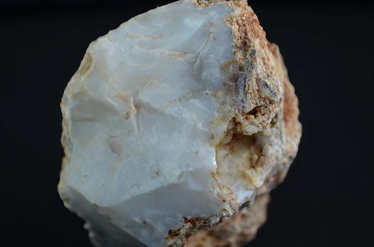
From a rock collecting viewpoint, the name refers to an opalite fossicking area, now out of bounds due to active gold mines nearby. It also refers to a now long gone small settlement which in the early 1900's serviced local prospectors. Historically and in modern times it refers to an area covering the mines itself.
This last aspect had caused several more grey hairs on the writer's head. Information is often listed as Grants Patch with no details of the specific mine. This has occurred even in modern times where exploration companies will take over a package of leases, calling it the Grant's Patch project.
The area follows a similar history to many other goldfields in the region. Prospectors develop shallow pits and underground workings following high grade narrow veins and lodes from the late 1890's to early 1900's. Minor renewed activity occurs in the 1930's, mainly prospectors, and limited company involvement in this area. From the 1980's onwards, companies take over large sections of the area, and develop small to medium sized open pits on an oxide resource, with the ore carted to the Paddington mill south of Broad Arrow.
Recent history has seen the area explored and limited mining by Ora Banda Amalgamated NL late 1930's, United Goldfields Corporation late 1970's, West Coast Holdings 1980's, Centaur Mining late 1980's, Cazaly 2004, Carbine Resources 2007-2008, Phoenix Gold 2010-2015, Evolution Mining 2015, Chaffers Mining 2015, Keras Resources 2015 to 2020, amongst others.
Norton Goldfields Limited at the time of writing (2016) controls most of the Black Flag Goldfield, and indeed some surrounding areas. Various pits have been developed by the company for short periods, before being abandoned for the next project. It also leases out areas to other companies. Keras Resources is active in the Grant's Patch area from 2016, under a 5 year tribute agreement. There was once a public road to Black Flag, but this has been closed, and no entry signs are posted across the entire region, due to active gold mining in parts.
Limited and general geology information was found for Grant's Patch. Gold is mostly found in the area in the Victorious Basalt. The stratigraphy is a basal basalt unit, overlain by komatiite, upper basalt, felsic volcano sedimentary formation, mafic and ultramafic rocks, overlain again by a coarse clastic sedimentary unit. Layered and mafic sills are found at various layers. The area shows broad folding with cross cutting brittle-ductile faults at variable directions. Gold is found in wide shear zones containing Fe stained quartz veins, the lodes generally trending north-south, and dipping south-west.
Select Mineral List Type
Standard Detailed Gallery Strunz Chemical ElementsCommodity List
This is a list of exploitable or exploited mineral commodities recorded from this region.Mineral List
Mineral list contains entries from the region specified including sub-localities7 valid minerals.
Rock Types Recorded
Note: data is currently VERY limited. Please bear with us while we work towards adding this information!
Rock list contains entries from the region specified including sub-localities
Select Rock List Type
Alphabetical List Tree DiagramDetailed Mineral List:
| ⓘ Chalcopyrite Formula: CuFeS2 |
| ⓘ Galena Formula: PbS |
| ⓘ Hematite Formula: Fe2O3 |
| ⓘ Native Gold Formula: Au Localities: Reported from at least 11 localities in this region. |
| ⓘ Opal Formula: SiO2 · nH2O |
| ⓘ Opal var. Common Opal Formula: SiO2 · nH2O |
| ⓘ Opal var. Moss Opal |
| ⓘ Pyrite Formula: FeS2 |
| ⓘ Talc Formula: Mg3Si4O10(OH)2 |

List of minerals arranged by Strunz 10th Edition classification
| Group 1 - Elements | |||
|---|---|---|---|
| ⓘ | Native Gold | 1.AA.05 | Au |
| Group 2 - Sulphides and Sulfosalts | |||
| ⓘ | Chalcopyrite | 2.CB.10a | CuFeS2 |
| ⓘ | Galena | 2.CD.10 | PbS |
| ⓘ | Pyrite | 2.EB.05a | FeS2 |
| Group 4 - Oxides and Hydroxides | |||
| ⓘ | Hematite | 4.CB.05 | Fe2O3 |
| ⓘ | Opal | 4.DA.10 | SiO2 · nH2O |
| ⓘ | var. Common Opal | 4.DA.10 | SiO2 · nH2O |
| ⓘ | var. Moss Opal | 4.DA.10 | SiO2 · nH2O |
| Group 9 - Silicates | |||
| ⓘ | Talc | 9.EC.05 | Mg3Si4O10(OH)2 |
List of minerals for each chemical element
| H | Hydrogen | |
|---|---|---|
| H | ⓘ Opal | SiO2 · nH2O |
| H | ⓘ Talc | Mg3Si4O10(OH)2 |
| H | ⓘ Opal var. Common Opal | SiO2 · nH2O |
| O | Oxygen | |
| O | ⓘ Hematite | Fe2O3 |
| O | ⓘ Opal | SiO2 · nH2O |
| O | ⓘ Talc | Mg3Si4O10(OH)2 |
| O | ⓘ Opal var. Common Opal | SiO2 · nH2O |
| Mg | Magnesium | |
| Mg | ⓘ Talc | Mg3Si4O10(OH)2 |
| Si | Silicon | |
| Si | ⓘ Opal | SiO2 · nH2O |
| Si | ⓘ Talc | Mg3Si4O10(OH)2 |
| Si | ⓘ Opal var. Common Opal | SiO2 · nH2O |
| S | Sulfur | |
| S | ⓘ Chalcopyrite | CuFeS2 |
| S | ⓘ Galena | PbS |
| S | ⓘ Pyrite | FeS2 |
| Fe | Iron | |
| Fe | ⓘ Chalcopyrite | CuFeS2 |
| Fe | ⓘ Hematite | Fe2O3 |
| Fe | ⓘ Pyrite | FeS2 |
| Cu | Copper | |
| Cu | ⓘ Chalcopyrite | CuFeS2 |
| Au | Gold | |
| Au | ⓘ Native Gold | Au |
| Pb | Lead | |
| Pb | ⓘ Galena | PbS |
Localities in this Region
- Western Australia
- Kalgoorlie-Boulder Shire
- Black Flag Goldfield
- Kalgoorlie-Boulder Shire
- Western Australia
- Kalgoorlie-Boulder Shire
- Black Flag Goldfield
- Kalgoorlie-Boulder Shire
Other Regions, Features and Areas containing this locality
Australia
- Western Australia
- Kambalda Nickel Metallogenic ProvinceGeologic Province
- West Australian ElementCraton
- Yilgarn CratonCraton
Australian PlateTectonic Plate
- West Australian Craton
- Eastern Yilgarn CratonCraton
This page contains all mineral locality references listed on mindat.org. This does not claim to be a complete list. If you know of more minerals from this site, please register so you can add to our database. This locality information is for reference purposes only. You should never attempt to
visit any sites listed in mindat.org without first ensuring that you have the permission of the land and/or mineral rights holders
for access and that you are aware of all safety precautions necessary.
References

Highland Fling Gold Mine, Grant's Patch, Black Flag Goldfield, Kalgoorlie-Boulder Shire, Western Australia, Australia