
North Keystone Mine (Keystone Mine), Copperopolis Mines (Copperopolis group), Copperopolis, Foothill Copper Belt, Calaveras County, California, USAi
This page is currently not sponsored. Click here to sponsor this page.
Latitude & Longitude (WGS84):
37° 59' 13'' North , 120° 38' 51'' West
Latitude & Longitude (decimal):
Type:
Köppen climate type:
Nearest Settlements:
| Place | Population | Distance |
|---|---|---|
| Copperopolis | 3,671 (2011) | 0.8km |
| Angels Camp | 2,677 (2012) | 13.1km |
| Tuttletown | 668 (2011) | 16.5km |
| Vallecito | 442 (2011) | 19.1km |
| Jamestown | 3,433 (2011) | 20.0km |
Nearest Clubs:
Local clubs are the best way to get access to collecting localities
Local clubs are the best way to get access to collecting localities
| Club | Location | Distance |
|---|---|---|
| Calaveras Gem & Mineral Society | Angels Camp, California | 13km |
| Amador County Gem & Mineral Society | Sutter Creek, California | 47km |
| Mother Lode Mineral Society | Modesto, California | 49km |
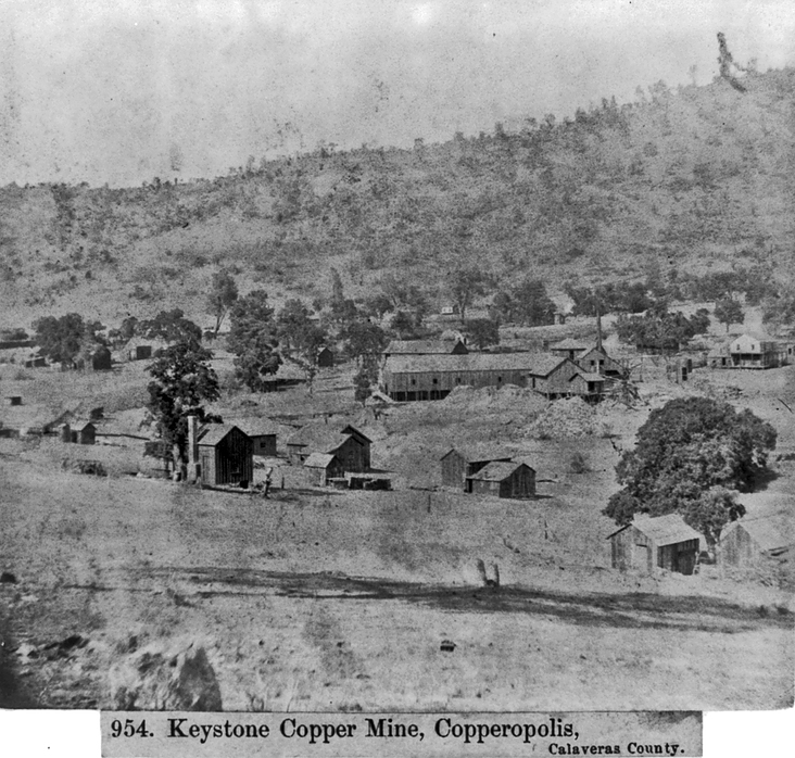
A former Cu-Au-Ag mine located in the NW¼ sec. 34, T2N, R12E, MDM, 0.6 km (0.4 mile) NW of Copperopolis, E of the Copperopolis Reservoir dam, on private (patented) land. Owned by the Lava Cap Mining Co., Nevada City, CA. Started about 1850; reopened about 1941. Operated during the periods 1861-1866, 1867, 1942, 1943, 1944 & 1945. MRDS database stated accuracy for this location is 100 meters.
NOTE: Confusion regarding this locality is likely in view of the existence of another mine in Copperopolis in the same T&R section, the Keystone-Union Mine (Calaveras Copper), located in the middle of Copperopolis. This mine (North Keystone Mine) has the two names presented above as per USGS MRDS database file #10028815. The topo map reflects two mines (or, probably more correctly, 2 mine shafts) - the Keystone, located on the N side of the Copperopolis Reservoir dam, and the North Keystone, located somewhat further N (about 2,000 feet), E of the N end of the reservoir. MRDS file #10260270 presents coordinates placing the mine at the southern shaft while MRDS file #10028815 places it at a point about halfway between the two shafts. The MRDS files reference each other as pertinent to the same mine. Further, both mines (Keystone-Union and North Keystone) were the subject of a common evaluation in 1970 by Lyman Moore.
Mineralization is a massive sulfide deposit (Mineral occurrence model information: Model code: 184; USGS model code: 28a; Deposit model name: Massive sulfide, kuroko; Mark3 model number: 93), hosted in Late Jurassic slate and schist. There are 3 principal ore bodies, each concordant with foliation of the enclosing rock, en echelon in plan. The North ore body has a strike length of 360 feet and a maximum width of 20 feet and a depth of at least 550 feet. The middle ore body is 240 feet in strike length at a maximum of 20 feet in width and extends downward for 525 feet from a depth of 300 feet. The South ore body is 285 feet long, at least 650 feet deep and 15 feet in maximum width. The ore body(ies) are lenticular in form. Controls for ore emplacement included: 1. A belt of intense chloritization; 2. Chloritized slate and schist (This aspect afforded the most favorable envioroment for penetration and replacement by copper-bearing solutions, the granodiorite did not); 3. "Footwall Fault" and subsidiary faults and fissures; and, 4. The larger ore bodies are parallel to segments of the "Footwall Fault" which has a more northerly strike.
Slate and metavolcanic rocks in the mine area strike NW. Cleavage schistosity and bedding dip steeply NE. The metavolcanics include pale green, spotted schist and greenstone from andesitic and dacitic rocks. Others include dark blue-gray argillaceous slaty tuffs, schistose pyroclastics, bedded hornstone and volcanic breccia. East of the mine is an elongate body of serpentine. South is an oval-shaped area of saussuritized gabbro. 1,000 feet N of the mine, there are several dikes of hornblendite breccia. Others include serpentine, hornblendite, diorite and the most significant - a large body of granodiorite. The ore is in black pyritous slate in a belt of amphibolite schist. Pyrite and chalcopyrite occur in many places intimately intergrown.
Local alteration includes chloritization. Local rocks include Mesozoic volcanic rocks, unit 2 (Western Sierra Foothills and Western Klamath Mountains).
Workings include underground openings with a length of 1315.21 meters and an overall depth of 339.85 meters. One three-compartment vertical shaft with 6 levels (150, 375, 525, 675, 875 and 1,075 feet). More than 3,200 feet of drifts were driven along strike on both sides of the shaft. A mineralized zone is at the 375 level.
Production data are found in: Heyl, George Richard (1948b).
1867 production was not reported.
Analytical data results: 1½ to 9% Cu.
Reserve-Resource data are presented in: Heyl, George Richard (1948b): 106.
Reserves and resources: Type: in-situ; Year: 1943: Total resources 4,000 metric tons of ore. Resource details: Cu: 3 weight percent (1943).
4 holes were drilled by the U.S. Bureau of Mines in 1943, totaling over 2,600 feet. Also presence of thin chalcopyrite-pyrite stringers W of the "Footwall Fault."
NOTE: Confusion regarding this locality is likely in view of the existence of another mine in Copperopolis in the same T&R section, the Keystone-Union Mine (Calaveras Copper), located in the middle of Copperopolis. This mine (North Keystone Mine) has the two names presented above as per USGS MRDS database file #10028815. The topo map reflects two mines (or, probably more correctly, 2 mine shafts) - the Keystone, located on the N side of the Copperopolis Reservoir dam, and the North Keystone, located somewhat further N (about 2,000 feet), E of the N end of the reservoir. MRDS file #10260270 presents coordinates placing the mine at the southern shaft while MRDS file #10028815 places it at a point about halfway between the two shafts. The MRDS files reference each other as pertinent to the same mine. Further, both mines (Keystone-Union and North Keystone) were the subject of a common evaluation in 1970 by Lyman Moore.
Mineralization is a massive sulfide deposit (Mineral occurrence model information: Model code: 184; USGS model code: 28a; Deposit model name: Massive sulfide, kuroko; Mark3 model number: 93), hosted in Late Jurassic slate and schist. There are 3 principal ore bodies, each concordant with foliation of the enclosing rock, en echelon in plan. The North ore body has a strike length of 360 feet and a maximum width of 20 feet and a depth of at least 550 feet. The middle ore body is 240 feet in strike length at a maximum of 20 feet in width and extends downward for 525 feet from a depth of 300 feet. The South ore body is 285 feet long, at least 650 feet deep and 15 feet in maximum width. The ore body(ies) are lenticular in form. Controls for ore emplacement included: 1. A belt of intense chloritization; 2. Chloritized slate and schist (This aspect afforded the most favorable envioroment for penetration and replacement by copper-bearing solutions, the granodiorite did not); 3. "Footwall Fault" and subsidiary faults and fissures; and, 4. The larger ore bodies are parallel to segments of the "Footwall Fault" which has a more northerly strike.
Slate and metavolcanic rocks in the mine area strike NW. Cleavage schistosity and bedding dip steeply NE. The metavolcanics include pale green, spotted schist and greenstone from andesitic and dacitic rocks. Others include dark blue-gray argillaceous slaty tuffs, schistose pyroclastics, bedded hornstone and volcanic breccia. East of the mine is an elongate body of serpentine. South is an oval-shaped area of saussuritized gabbro. 1,000 feet N of the mine, there are several dikes of hornblendite breccia. Others include serpentine, hornblendite, diorite and the most significant - a large body of granodiorite. The ore is in black pyritous slate in a belt of amphibolite schist. Pyrite and chalcopyrite occur in many places intimately intergrown.
Local alteration includes chloritization. Local rocks include Mesozoic volcanic rocks, unit 2 (Western Sierra Foothills and Western Klamath Mountains).
Workings include underground openings with a length of 1315.21 meters and an overall depth of 339.85 meters. One three-compartment vertical shaft with 6 levels (150, 375, 525, 675, 875 and 1,075 feet). More than 3,200 feet of drifts were driven along strike on both sides of the shaft. A mineralized zone is at the 375 level.
Production data are found in: Heyl, George Richard (1948b).
1867 production was not reported.
Analytical data results: 1½ to 9% Cu.
Reserve-Resource data are presented in: Heyl, George Richard (1948b): 106.
Reserves and resources: Type: in-situ; Year: 1943: Total resources 4,000 metric tons of ore. Resource details: Cu: 3 weight percent (1943).
4 holes were drilled by the U.S. Bureau of Mines in 1943, totaling over 2,600 feet. Also presence of thin chalcopyrite-pyrite stringers W of the "Footwall Fault."
Select Mineral List Type
Standard Detailed Gallery Strunz Chemical ElementsMineral List
14 valid minerals.
Rock Types Recorded
Select Rock List Type
Alphabetical List Tree DiagramDetailed Mineral List:
| ⓘ Andalusite Formula: Al2(SiO4)O |
| ⓘ Bornite Formula: Cu5FeS4 |
| ⓘ Calcite Formula: CaCO3 |
| ⓘ Chalcopyrite Formula: CuFeS2 Description: Occurs often intimately associated withm pyrite. |
| ⓘ 'Chlorite Group' Description: Occurs as an alteration product. |
| ⓘ Cuprite Formula: Cu2O |
| ⓘ Epidote Formula: (CaCa)(AlAlFe3+)O[Si2O7][SiO4](OH) |
| ⓘ Hematite Formula: Fe2O3 |
| ⓘ Ilmenite Formula: Fe2+TiO3 |
| ⓘ Malachite Formula: Cu2(CO3)(OH)2 |
| ⓘ Native Copper Formula: Cu References: |
| ⓘ Pyrite Formula: FeS2 Description: Occurs often intimately associated with chalcopyrite. |
| ⓘ Quartz Formula: SiO2 |
| ⓘ Rutile Formula: TiO2 |
| ⓘ Titanite Formula: CaTiO(SiO4) |
Gallery:
List of minerals arranged by Strunz 10th Edition classification
| Group 1 - Elements | |||
|---|---|---|---|
| ⓘ | Native Copper | 1.AA.05 | Cu |
| Group 2 - Sulphides and Sulfosalts | |||
| ⓘ | Bornite | 2.BA.15 | Cu5FeS4 |
| ⓘ | Chalcopyrite | 2.CB.10a | CuFeS2 |
| ⓘ | Pyrite | 2.EB.05a | FeS2 |
| Group 4 - Oxides and Hydroxides | |||
| ⓘ | Cuprite | 4.AA.10 | Cu2O |
| ⓘ | Hematite | 4.CB.05 | Fe2O3 |
| ⓘ | Ilmenite | 4.CB.05 | Fe2+TiO3 |
| ⓘ | Quartz | 4.DA.05 | SiO2 |
| ⓘ | Rutile | 4.DB.05 | TiO2 |
| Group 5 - Nitrates and Carbonates | |||
| ⓘ | Calcite | 5.AB.05 | CaCO3 |
| ⓘ | Malachite | 5.BA.10 | Cu2(CO3)(OH)2 |
| Group 9 - Silicates | |||
| ⓘ | Andalusite | 9.AF.10 | Al2(SiO4)O |
| ⓘ | Titanite | 9.AG.15 | CaTiO(SiO4) |
| ⓘ | Epidote | 9.BG.05a | (CaCa)(AlAlFe3+)O[Si2O7][SiO4](OH) |
| Unclassified | |||
| ⓘ | 'Chlorite Group' | - | |
List of minerals for each chemical element
| H | Hydrogen | |
|---|---|---|
| H | ⓘ Epidote | (CaCa)(AlAlFe3+)O[Si2O7][SiO4](OH) |
| H | ⓘ Malachite | Cu2(CO3)(OH)2 |
| C | Carbon | |
| C | ⓘ Calcite | CaCO3 |
| C | ⓘ Malachite | Cu2(CO3)(OH)2 |
| O | Oxygen | |
| O | ⓘ Andalusite | Al2(SiO4)O |
| O | ⓘ Calcite | CaCO3 |
| O | ⓘ Cuprite | Cu2O |
| O | ⓘ Epidote | (CaCa)(AlAlFe3+)O[Si2O7][SiO4](OH) |
| O | ⓘ Hematite | Fe2O3 |
| O | ⓘ Ilmenite | Fe2+TiO3 |
| O | ⓘ Malachite | Cu2(CO3)(OH)2 |
| O | ⓘ Quartz | SiO2 |
| O | ⓘ Rutile | TiO2 |
| O | ⓘ Titanite | CaTiO(SiO4) |
| Al | Aluminium | |
| Al | ⓘ Andalusite | Al2(SiO4)O |
| Al | ⓘ Epidote | (CaCa)(AlAlFe3+)O[Si2O7][SiO4](OH) |
| Si | Silicon | |
| Si | ⓘ Andalusite | Al2(SiO4)O |
| Si | ⓘ Epidote | (CaCa)(AlAlFe3+)O[Si2O7][SiO4](OH) |
| Si | ⓘ Quartz | SiO2 |
| Si | ⓘ Titanite | CaTiO(SiO4) |
| S | Sulfur | |
| S | ⓘ Bornite | Cu5FeS4 |
| S | ⓘ Chalcopyrite | CuFeS2 |
| S | ⓘ Pyrite | FeS2 |
| Ca | Calcium | |
| Ca | ⓘ Calcite | CaCO3 |
| Ca | ⓘ Epidote | (CaCa)(AlAlFe3+)O[Si2O7][SiO4](OH) |
| Ca | ⓘ Titanite | CaTiO(SiO4) |
| Ti | Titanium | |
| Ti | ⓘ Ilmenite | Fe2+TiO3 |
| Ti | ⓘ Rutile | TiO2 |
| Ti | ⓘ Titanite | CaTiO(SiO4) |
| Fe | Iron | |
| Fe | ⓘ Bornite | Cu5FeS4 |
| Fe | ⓘ Chalcopyrite | CuFeS2 |
| Fe | ⓘ Epidote | (CaCa)(AlAlFe3+)O[Si2O7][SiO4](OH) |
| Fe | ⓘ Hematite | Fe2O3 |
| Fe | ⓘ Ilmenite | Fe2+TiO3 |
| Fe | ⓘ Pyrite | FeS2 |
| Cu | Copper | |
| Cu | ⓘ Bornite | Cu5FeS4 |
| Cu | ⓘ Chalcopyrite | CuFeS2 |
| Cu | ⓘ Cuprite | Cu2O |
| Cu | ⓘ Native Copper | Cu |
| Cu | ⓘ Malachite | Cu2(CO3)(OH)2 |
Other Databases
| Link to USGS MRDS: | 10028815 |
|---|
Other Regions, Features and Areas containing this locality
North AmericaContinent
North America PlateTectonic Plate
- Foothills-Wallowa DomainDomain
- Sierra Nevada BatholithVolcanic Arc
USA
- California
- Mother Lode BeltBelt
This page contains all mineral locality references listed on mindat.org. This does not claim to be a complete list. If you know of more minerals from this site, please register so you can add to our database. This locality information is for reference purposes only. You should never attempt to
visit any sites listed in mindat.org without first ensuring that you have the permission of the land and/or mineral rights holders
for access and that you are aware of all safety precautions necessary.

North Keystone Mine, Copperopolis Mines, Copperopolis, Foothill Copper Belt, Calaveras County, California, USA