
Eastgate Quarry, Eastgate, Stanhope, County Durham, England, UKi
| Regional Level Types | |
|---|---|
| Eastgate Quarry | Quarry (In Development) |
| Eastgate | Village |
| Stanhope | Civil Parish |
| County Durham | County |
| England | Constituent Country |
| UK | Country |
Eastgate Quarry, Eastgate, Weardale, County Durham, England, UK
This page is currently not sponsored. Click here to sponsor this page.

Latitude & Longitude (WGS84):
54° 43' 40'' North , 2° 4' 39'' West
Latitude & Longitude (decimal):
UK National Grid Reference:
NY950370
Type:
Quarry (In Development) - last checked 2020
Köppen climate type:
Nearest Settlements:
| Place | Population | Distance |
|---|---|---|
| Stanhope | 1,602 (2017) | 4.6km |
| Frosterley | 636 (2017) | 7.6km |
| Middleton in Teesdale | 934 (2017) | 11.4km |
| Wolsingham | 2,503 (2017) | 12.5km |
| Mickleton | 413 (2017) | 13.4km |
Other/historical names associated with this locality:
Blue Circle Cement Quarry
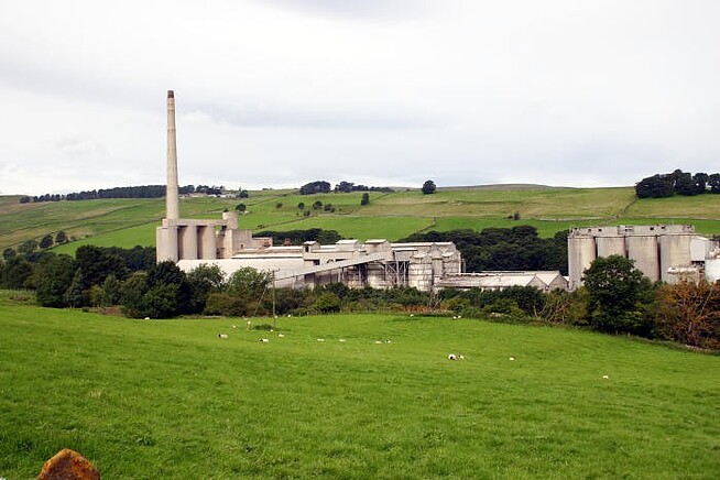
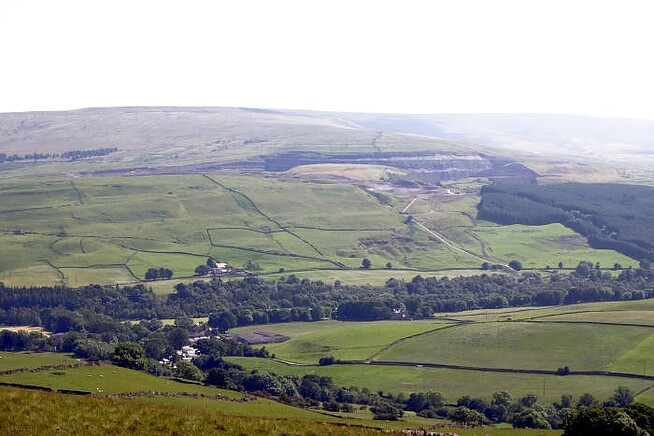
The Blue Circle Cement Quarry worked an exposure of the Great Limestone on the south side of the Wear River between the villages of Eastgate and Westgate. The quarry was operated by Blue Circle Industries (a British public company) from the mid-1960s and was acquired by the French company Lafarge in 2001 and worked until closure in 2002-2003. It is the third source, along with the Heights Quarry and Rogerley Mine, of emerald green fluorite in Weardale. Fluorite crystals from the Cement Quarry are often paler green than either the Heights or Rogerley and usually have a purplish-grey cast due to internal purple colour zones. Yellow, pale blue and purple fluorite are also found. Mineralisation is found in flats associated with ore-bearing veins in exposures of the Great Limestone. No studies of mineralisation in the quarry have been published, but it is likely that mineralisation occurs along an extension of the Heights West Cross Vein on the south side of the River Wear.
In 2004, it was announced that a hot geothermal power plant would go ahead on the site of a former cement works. The geothermal plant was planned to heat the UK's first geothermal energy model village, the official working title being Eastgate Renewable Energy Village. But the plan fell through, and instead of the village a large outdoor set was built for the filming of the ITV series Beowulf: Return to the Shieldlands, first broadcast in 2016.
The exploratory geothermal borehole drilled in December 2004 was the first to be completed in the United Kingdom for more than 20 years. The water temperature at a depth of 995 metres (ca. 3,264 ft) was found to be 46.2 °C, and it was estimated that the water temperature of a production borehole with a depth of about 1,800 metres (ca. 5,906 ft) would be in the range of 75–80 °C, with a volume of water similar to that already being exploited in the existing geothermal energy scheme in Southampton.
A new specimen mining operation called the "Lady Annabella mine" (named for Annabella Bruce, the daughter of Ian and Diana Bruce of UK Mining Ventures) started operating on fluorite veins in 2020. Specimen recovery from this mine began in July of that year.
In 2004, it was announced that a hot geothermal power plant would go ahead on the site of a former cement works. The geothermal plant was planned to heat the UK's first geothermal energy model village, the official working title being Eastgate Renewable Energy Village. But the plan fell through, and instead of the village a large outdoor set was built for the filming of the ITV series Beowulf: Return to the Shieldlands, first broadcast in 2016.
The exploratory geothermal borehole drilled in December 2004 was the first to be completed in the United Kingdom for more than 20 years. The water temperature at a depth of 995 metres (ca. 3,264 ft) was found to be 46.2 °C, and it was estimated that the water temperature of a production borehole with a depth of about 1,800 metres (ca. 5,906 ft) would be in the range of 75–80 °C, with a volume of water similar to that already being exploited in the existing geothermal energy scheme in Southampton.
A new specimen mining operation called the "Lady Annabella mine" (named for Annabella Bruce, the daughter of Ian and Diana Bruce of UK Mining Ventures) started operating on fluorite veins in 2020. Specimen recovery from this mine began in July of that year.
Select Mineral List Type
Standard Detailed Gallery Strunz Chemical ElementsCommodity List
This is a list of exploitable or exploited mineral commodities recorded from this region.Mineral List
Mineral list contains entries from the region specified including sub-localities9 valid minerals.
Rock Types Recorded
Rock list contains entries from the region specified including sub-localities
Select Rock List Type
Alphabetical List Tree DiagramDetailed Mineral List:
| ⓘ Aragonite Formula: CaCO3 References: |
| ⓘ Calcite Formula: CaCO3 Localities: Lady Annabella Mine, Eastgate Quarry, Eastgate, Stanhope, County Durham, England, UK Eastgate Quarry, Eastgate, Stanhope, County Durham, England, UK Bull Vein, Lady Annabella Mine, Eastgate Quarry, Eastgate, Stanhope, County Durham, England, UK Harvest Pocket, Bull Vein, Lady Annabella Mine, Eastgate Quarry, Eastgate, Stanhope, County Durham, England, UK Fairy Holes Pocket, Fairy Hole Vein, Lady Annabella Mine, Eastgate Quarry, Eastgate, Stanhope, County Durham, England, UK |
| ⓘ Fluorite Formula: CaF2 Localities: Reported from at least 19 localities in this region. |
| ⓘ Galena Formula: PbS Localities: Reported from at least 6 localities in this region. |
| ⓘ Goethite Formula: Fe3+O(OH) References: |
| ⓘ Hydrocerussite Formula: Pb3(CO3)2(OH)2 |
| ⓘ Pyrite Formula: FeS2 References: |
| ⓘ Quartz Formula: SiO2 Localities: Reported from at least 6 localities in this region. |
| ⓘ Siderite Formula: FeCO3 |

List of minerals arranged by Strunz 10th Edition classification
| Group 2 - Sulphides and Sulfosalts | |||
|---|---|---|---|
| ⓘ | Galena | 2.CD.10 | PbS |
| ⓘ | Pyrite | 2.EB.05a | FeS2 |
| Group 3 - Halides | |||
| ⓘ | Fluorite | 3.AB.25 | CaF2 |
| Group 4 - Oxides and Hydroxides | |||
| ⓘ | Goethite | 4.00. | Fe3+O(OH) |
| ⓘ | Quartz | 4.DA.05 | SiO2 |
| Group 5 - Nitrates and Carbonates | |||
| ⓘ | Calcite | 5.AB.05 | CaCO3 |
| ⓘ | Siderite | 5.AB.05 | FeCO3 |
| ⓘ | Aragonite | 5.AB.15 | CaCO3 |
| ⓘ | Hydrocerussite | 5.BE.10 | Pb3(CO3)2(OH)2 |
List of minerals for each chemical element
| H | Hydrogen | |
|---|---|---|
| H | ⓘ Goethite | Fe3+O(OH) |
| H | ⓘ Hydrocerussite | Pb3(CO3)2(OH)2 |
| C | Carbon | |
| C | ⓘ Aragonite | CaCO3 |
| C | ⓘ Calcite | CaCO3 |
| C | ⓘ Hydrocerussite | Pb3(CO3)2(OH)2 |
| C | ⓘ Siderite | FeCO3 |
| O | Oxygen | |
| O | ⓘ Aragonite | CaCO3 |
| O | ⓘ Calcite | CaCO3 |
| O | ⓘ Goethite | Fe3+O(OH) |
| O | ⓘ Hydrocerussite | Pb3(CO3)2(OH)2 |
| O | ⓘ Quartz | SiO2 |
| O | ⓘ Siderite | FeCO3 |
| F | Fluorine | |
| F | ⓘ Fluorite | CaF2 |
| Si | Silicon | |
| Si | ⓘ Quartz | SiO2 |
| S | Sulfur | |
| S | ⓘ Galena | PbS |
| S | ⓘ Pyrite | FeS2 |
| Ca | Calcium | |
| Ca | ⓘ Aragonite | CaCO3 |
| Ca | ⓘ Calcite | CaCO3 |
| Ca | ⓘ Fluorite | CaF2 |
| Fe | Iron | |
| Fe | ⓘ Goethite | Fe3+O(OH) |
| Fe | ⓘ Pyrite | FeS2 |
| Fe | ⓘ Siderite | FeCO3 |
| Pb | Lead | |
| Pb | ⓘ Galena | PbS |
| Pb | ⓘ Hydrocerussite | Pb3(CO3)2(OH)2 |
Localities in this Region
- England
- County Durham
- Stanhope
- County Durham
- England
- County Durham
- Stanhope
- Eastgate
- Eastgate Quarry
- Lady Annabella Mine
- Eastgate Quarry
- Eastgate
- Stanhope
- County Durham
Other Regions, Features and Areas containing this locality
British and Irish IslesGroup of Islands
Eurasian PlateTectonic Plate
- AvaloniaVolcanic Arc
EuropeContinent
UK
- England
- County Durham
- WeardaleRiver Valley
- Northern Pennine OrefieldOre Field
- The PenninesRange of Mountains and Hills
- County Durham
This page contains all mineral locality references listed on mindat.org. This does not claim to be a complete list. If you know of more minerals from this site, please register so you can add to our database. This locality information is for reference purposes only. You should never attempt to
visit any sites listed in mindat.org without first ensuring that you have the permission of the land and/or mineral rights holders
for access and that you are aware of all safety precautions necessary.
References

Eastgate Quarry, Eastgate, Stanhope, County Durham, England, UK