
Crown King Mine (Crowned King Patent MS 1776 claim; Patented claims MS 824; 825; 1716), Crown King, Pine Grove Mining District, Bradshaw Mountains (Bradshaw Range), Yavapai County, Arizona, USAi
This page is currently not sponsored. Click here to sponsor this page.


Latitude & Longitude (WGS84):
34° 13' 29'' North , 112° 20' 35'' West
Latitude & Longitude (decimal):
Type:
Köppen climate type:
Nearest Settlements:
| Place | Population | Distance |
|---|---|---|
| Spring Valley | 1,148 (2011) | 21.5km |
| Mayer | 1,497 (2011) | 21.6km |
| Cordes Lakes | 2,633 (2011) | 23.9km |
| Black Canyon City | 2,837 (2011) | 24.6km |
| Wilhoit | 868 (2011) | 31.6km |
Nearest Clubs:
Local clubs are the best way to get access to collecting localities
Local clubs are the best way to get access to collecting localities
| Club | Location | Distance |
|---|---|---|
| Black Canyon City Rock Club | Black Canyon City, Arizona | 25km |
| Prescott Gem & Mineral Club | Prescott Valley, Arizona | 43km |
| Daisy Mountain Rock & Mineral Club | Anthem, Arizona | 44km |
| Wickenburg Gem and Mineral Society | Wickenburg, Arizona | 46km |
A former underground Au-Ag-Pb-Zn-Cu-V mine located on 8 claims, SE of Towers Mountain at 6,400 feet of altitude (tunnel level). Started 1890 and closed 1895. Reopened 1916 and closed 1919. Owned by Place, Scheckels & Harrington; the Crown King Mining Co. (1890-1895); property bonded to H.B. Chamberlain & Co. of Denver, operated until 1901 and closed by court order; Crown King Mining Co. worked the middlings pile (1906-1907); sold at receivers sale (1909), to the Yavapai Consolidated Gold-Silver-Copper Co.; Mr Murphy (1914- ); lessees organized the Bradshaw Reduction Co. (1916) and processed old middlings; 1923 - taken over by Crown King Consolidated Mines, Inc; and the Murphy estate as Yavapai Consolidated Gold-Silver-Copper Co. (1926).
Mineralization is the Crown King vein with a tabular ore body and rich gold ore near surface. The vein strikes NNE and dips 70ºW. and cuts across the contact between granodiorite and sedimentary Yavapai Schist, which has been intruded by a dike of rhyolite porphyry. It averages 2 feet (0.6 meters) wide and splits toward the North and contains 2 gently Northward-pitching oreshoots. Ore consists of quartz with free gold and sulfides. Ore control was faulting and shearing. Ore concentration was oxidation of near surface ores. No alteration noted. An associated rock unit is the Crazy Basin Quartz Monzonite, the Crown King Granodiorite (informal), and rhyolite dikes.
Area structures include foliation that trends N25E, and the vein that trends parallel to the foliation. Veins parallel regional foliation of N2025E.
Workings were 650 feet deep by 1901 with a 480 foot deep shaft, a 913 foot tunnel 150 feet below the shaft collar and a 500 foot winze with 5 levels, each extending about 1,200 feet North and from 200 to 500 feet South of the winze. Ore averaged 0.5 oz. Au/T and 4 oz. Ag/T. A 10-stamp mill was erected on the property.
Select Mineral List Type
Standard Detailed Gallery Strunz Chemical ElementsDetailed Mineral List:
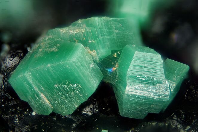
| ⓘ Beudantite Formula: PbFe3+3(AsO4)(SO4)(OH)6 Colour: Greenish Description: Crusts in vein matter. |
| ⓘ Calcite Formula: CaCO3 |
| ⓘ Chalcopyrite Formula: CuFeS2 |
| ⓘ Jarosite Formula: KFe3+3(SO4)2(OH)6 |
| ⓘ Metatorbernite Formula: Cu(UO2)2(PO4)2 · 8H2O |
| ⓘ Native Gold Formula: Au Description: Free lode gold; coarse, with sulfides. |
| ⓘ Pyrite Formula: FeS2 Description: Abundant. |
| ⓘ Sphalerite Formula: ZnS Description: Abundant. |
Gallery:

List of minerals arranged by Strunz 10th Edition classification
| Group 1 - Elements | |||
|---|---|---|---|
| ⓘ | Native Gold | 1.AA.05 | Au |
| Group 2 - Sulphides and Sulfosalts | |||
| ⓘ | Sphalerite | 2.CB.05a | ZnS |
| ⓘ | Chalcopyrite | 2.CB.10a | CuFeS2 |
| ⓘ | Pyrite | 2.EB.05a | FeS2 |
| Group 5 - Nitrates and Carbonates | |||
| ⓘ | Calcite | 5.AB.05 | CaCO3 |
| Group 7 - Sulphates, Chromates, Molybdates and Tungstates | |||
| ⓘ | Jarosite | 7.BC.10 | KFe3+3(SO4)2(OH)6 |
| Group 8 - Phosphates, Arsenates and Vanadates | |||
| ⓘ | Beudantite | 8.BL.05 | PbFe3+3(AsO4)(SO4)(OH)6 |
| ⓘ | Metatorbernite | 8.EB.10 | Cu(UO2)2(PO4)2 · 8H2O |
List of minerals for each chemical element
| H | Hydrogen | |
|---|---|---|
| H | ⓘ Beudantite | PbFe33+(AsO4)(SO4)(OH)6 |
| H | ⓘ Jarosite | KFe33+(SO4)2(OH)6 |
| H | ⓘ Metatorbernite | Cu(UO2)2(PO4)2 · 8H2O |
| C | Carbon | |
| C | ⓘ Calcite | CaCO3 |
| O | Oxygen | |
| O | ⓘ Beudantite | PbFe33+(AsO4)(SO4)(OH)6 |
| O | ⓘ Calcite | CaCO3 |
| O | ⓘ Jarosite | KFe33+(SO4)2(OH)6 |
| O | ⓘ Metatorbernite | Cu(UO2)2(PO4)2 · 8H2O |
| P | Phosphorus | |
| P | ⓘ Metatorbernite | Cu(UO2)2(PO4)2 · 8H2O |
| S | Sulfur | |
| S | ⓘ Beudantite | PbFe33+(AsO4)(SO4)(OH)6 |
| S | ⓘ Chalcopyrite | CuFeS2 |
| S | ⓘ Jarosite | KFe33+(SO4)2(OH)6 |
| S | ⓘ Pyrite | FeS2 |
| S | ⓘ Sphalerite | ZnS |
| K | Potassium | |
| K | ⓘ Jarosite | KFe33+(SO4)2(OH)6 |
| Ca | Calcium | |
| Ca | ⓘ Calcite | CaCO3 |
| Fe | Iron | |
| Fe | ⓘ Beudantite | PbFe33+(AsO4)(SO4)(OH)6 |
| Fe | ⓘ Chalcopyrite | CuFeS2 |
| Fe | ⓘ Jarosite | KFe33+(SO4)2(OH)6 |
| Fe | ⓘ Pyrite | FeS2 |
| Cu | Copper | |
| Cu | ⓘ Chalcopyrite | CuFeS2 |
| Cu | ⓘ Metatorbernite | Cu(UO2)2(PO4)2 · 8H2O |
| Zn | Zinc | |
| Zn | ⓘ Sphalerite | ZnS |
| As | Arsenic | |
| As | ⓘ Beudantite | PbFe33+(AsO4)(SO4)(OH)6 |
| Au | Gold | |
| Au | ⓘ Native Gold | Au |
| Pb | Lead | |
| Pb | ⓘ Beudantite | PbFe33+(AsO4)(SO4)(OH)6 |
| U | Uranium | |
| U | ⓘ Metatorbernite | Cu(UO2)2(PO4)2 · 8H2O |
Other Regions, Features and Areas containing this locality
North AmericaContinent
North America PlateTectonic Plate
- Basin and Range BasinsBasin
- Great Plains DomainDomain
- Southern Basin and RangeWide Rift
This page contains all mineral locality references listed on mindat.org. This does not claim to be a complete list. If you know of more minerals from this site, please register so you can add to our database. This locality information is for reference purposes only. You should never attempt to
visit any sites listed in mindat.org without first ensuring that you have the permission of the land and/or mineral rights holders
for access and that you are aware of all safety precautions necessary.

Crown King Mine, Crown King, Pine Grove Mining District, Bradshaw Mountains, Yavapai County, Arizona, USA