
Cashin Mine (Red Chief claim; Titon claim; Angell claim; Horse Shoe claim; Bennie claim; Maud claim; Humboldt claim), La Sal Mining District (Paradox Valley Mining District), Montrose County, Colorado, USAi
This page kindly sponsored by Frank Karasti


Latitude & Longitude (WGS84):
38° 18' 38'' North , 108° 56' 56'' West
Latitude & Longitude (decimal):
Type:
Köppen climate type:
Nearest Settlements:
| Place | Population | Distance |
|---|---|---|
| La Sal | 395 (2011) | 26.1km |
| Naturita | 528 (2017) | 34.7km |
| Nucla | 702 (2017) | 35.3km |
| Castle Valley | 342 (2017) | 54.2km |
| Monticello | 2,069 (2017) | 59.8km |
A Cu-Ag-Au-Pb-Zn-U-Sb-As occurrence/mine located in secs. 22 & 23, T47N, R19W, NMM, about 7.2 km S of Paradox (air miles) along La Sal Creek and about 12 miles S71W from Uravan (site). Discovered in 1896. Last recorded production was in 1972. MRDS database stated accuracy for this locality is 10 meters.
The claims lie across La Sal Creek and onto Nyswonger Mesa, about 2.5 miles above the confluence with the Dolores River, 4 miles SSE of Oaradox and 3.2 miles WNW of Bedrock. The geographic coordinates given by the USGS are for the principal tunnel in the SE¼NW¼SE¼ of sec. 22.
The La Sal Mining District includes both the Cashin Mine and the Cliff Dweller Mine located about 1,500 feet to the west. The properties were first staked in 1895 by James N. McBride (Claimant) and mining began in 1896, with the development of underground access and stoping on the highly mineralized portions of the Cashin fault. First production occurred in 1898 and activity ended in 1972. The mine operated intermittently until 1946. Total production from the two mines was approximately 1.8 million pounds of Cu and 425,000 ounces of Ag from a total of 23,000 tons of ore averaging 4.0% Cu and 18.5 ounces per ton of Ag. The Cashin Mine developed workings for some 2,200 horizontal and 300 vertical feet over widths of 1 to 20 feet on the north side of La Sal Creek. To the south of the creek, an adit extends for a further 300 feet to the south with Cu mineralization visible along its length. The historic production has been exclusively from the highly mineralized fault zones. The potential for exploitation of the disseminated mineralization adjacent to the structures was identified in the 1960’s. This led to a geochemical sampling and drilling program in the period from 1967-1969. A total of 4,379 feet of small diameter core was drilled in 43 drill holes.
This deposit was discovered in 1896 but no active development took place until 1898. The first operator apparently was the La Sal Copper Mining Company, that sold the property in 1918-1919 to the Michigan-Colorado Copper Company. Due to high transportation costs in the early years only high-grade sulfide and native copper ore could be mined. A small leach plant and smelter produced matte in the early 1900's, using pyrite from Ophir and coal from ovens W of Naturita. Intermittent production took place by various operators from 1922 to 1946. Further exploration/development and rehabilitation was conducted by the Cashin Copper Corporation in 1955, Interstate Oil and Gas in 1962, Gold Bar Resources in 1963 to 1965, and Austin Smith in 1972, who shipped 50 tons of dump ore to a leach plant in the Lisbon Valley, Utah, but no values were recovered. In 1981, the New Star Corporation acquired the property (Mining Record, 12/2/1981), and performed exploration and development, and shipped a trial lot of 500 tons of ore that were successfully milled.
Claims: Cashin; MS 1303a; Michigan; MS 19163; Titon Mill Site; MS 13030b; Patented Claims: Red Chief; MS 13029a; Titon; MS 13030a; Angell; MS 13031a; Horse Shoe; MS 19163; Bennie; MS 13031a; Maud Mill Site; MS 13031b; Maud; MS 13031a; Humboldt; MS 13031a.
Owned by the New Star Corporation, Provo, Utah (1981---). Also owned by the Sumito Minerals Corporation of Canada (timeframe unstated). Operated by Austin B. Smith (1972).
Mineralization is a Cu deposit (Mineral occurrence model information: Model code: 197; USGS model code: 30b; BC deposit profile: E04; Deposit model name: Sediment-hosted Cu; Mark3 model number: 63), hosted in Late Jurassic shale and the Wingate Sandstone of the Chinle Formation. The ore body is 6.1 meters thick. Controls for ore emplacement included a fault cutting poorly cemented, friable sandstone. Local alteration includes oxidation of Cu sulfides to carbonates and oxides. Local rocks include Glen Canyon Group and the Chinle Formation.
Regional geologic structures include the Paradox Basin Fold and Fault Belt. Local structures include the Paradox Anticline, Paradox Valley Graben, and unnamed faults.
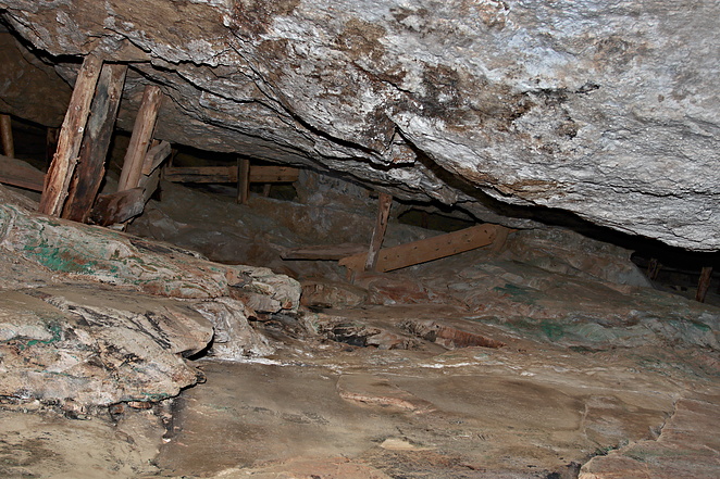
Workings include underground openings. The mine was developed by a main tunnel at 2,900 feet long with a 600 foot long overhead stope and two 300 foot raises. Three levels were developed off a 260 foot inclined winze: 100 level with 300 foot N and 180 foot S drifts; 160 level with 100 foot N and 100 foot S drifts. and the 260 level with 30 foot N and 30 foot S drifts. The Maud tunnel is 380 feet long with an 80 foot shaft at its portal. Two leach ponds were constructed near the main tunnel to treat dump material.
Production information: There is only a partial production record. The annual totals for 1899 to 1918 are unavailable. Cumulative totals for 1899 to 1905 from Emmons (1906). No production was cited in Colorado Division of Mines records for 1919 to 1921, 1923 to 1936, 1938, 1940 to 1971, and after 1972. Annual figures for 1938 to 1955 were found in the U.S. Bureau of Mines Mineral Yearbooks. The figure for 1939 includes a small production from the Independence No. 7 claim. The figure for 1940 includes a small production from the Talbert claim. Cu production in 1955 was covellite specimens for a rock shop. Production figures recorded for the district in 1957-1958, 1960, and 1964, but Mineral Yearbooks did not state whether or not all or bulk of this production was credited to the Cashin Mine.
Ore mined in 1937 and 1939 contained 7 to 8% Cu, 8 ounces/ton Ag and a trace of Au. High-grade, crude ore was shipped in 1922 and contained 12% Cu and 68 ounces Ag/ton. Other high-grade ore averaged 12.5% Cu and 134 ounces Ag/ton. The former leaching operation at the mine yielded an average of 3.5% Cu and 28 ounces Ag/ton. One shipment of native copper ore contained 89% Cu and 77 ounces Ag/ton.
The claims lie across La Sal Creek and onto Nyswonger Mesa, about 2.5 miles above the confluence with the Dolores River, 4 miles SSE of Oaradox and 3.2 miles WNW of Bedrock. The geographic coordinates given by the USGS are for the principal tunnel in the SE¼NW¼SE¼ of sec. 22.
The La Sal Mining District includes both the Cashin Mine and the Cliff Dweller Mine located about 1,500 feet to the west. The properties were first staked in 1895 by James N. McBride (Claimant) and mining began in 1896, with the development of underground access and stoping on the highly mineralized portions of the Cashin fault. First production occurred in 1898 and activity ended in 1972. The mine operated intermittently until 1946. Total production from the two mines was approximately 1.8 million pounds of Cu and 425,000 ounces of Ag from a total of 23,000 tons of ore averaging 4.0% Cu and 18.5 ounces per ton of Ag. The Cashin Mine developed workings for some 2,200 horizontal and 300 vertical feet over widths of 1 to 20 feet on the north side of La Sal Creek. To the south of the creek, an adit extends for a further 300 feet to the south with Cu mineralization visible along its length. The historic production has been exclusively from the highly mineralized fault zones. The potential for exploitation of the disseminated mineralization adjacent to the structures was identified in the 1960’s. This led to a geochemical sampling and drilling program in the period from 1967-1969. A total of 4,379 feet of small diameter core was drilled in 43 drill holes.
This deposit was discovered in 1896 but no active development took place until 1898. The first operator apparently was the La Sal Copper Mining Company, that sold the property in 1918-1919 to the Michigan-Colorado Copper Company. Due to high transportation costs in the early years only high-grade sulfide and native copper ore could be mined. A small leach plant and smelter produced matte in the early 1900's, using pyrite from Ophir and coal from ovens W of Naturita. Intermittent production took place by various operators from 1922 to 1946. Further exploration/development and rehabilitation was conducted by the Cashin Copper Corporation in 1955, Interstate Oil and Gas in 1962, Gold Bar Resources in 1963 to 1965, and Austin Smith in 1972, who shipped 50 tons of dump ore to a leach plant in the Lisbon Valley, Utah, but no values were recovered. In 1981, the New Star Corporation acquired the property (Mining Record, 12/2/1981), and performed exploration and development, and shipped a trial lot of 500 tons of ore that were successfully milled.
Claims: Cashin; MS 1303a; Michigan; MS 19163; Titon Mill Site; MS 13030b; Patented Claims: Red Chief; MS 13029a; Titon; MS 13030a; Angell; MS 13031a; Horse Shoe; MS 19163; Bennie; MS 13031a; Maud Mill Site; MS 13031b; Maud; MS 13031a; Humboldt; MS 13031a.
Owned by the New Star Corporation, Provo, Utah (1981---). Also owned by the Sumito Minerals Corporation of Canada (timeframe unstated). Operated by Austin B. Smith (1972).
Mineralization is a Cu deposit (Mineral occurrence model information: Model code: 197; USGS model code: 30b; BC deposit profile: E04; Deposit model name: Sediment-hosted Cu; Mark3 model number: 63), hosted in Late Jurassic shale and the Wingate Sandstone of the Chinle Formation. The ore body is 6.1 meters thick. Controls for ore emplacement included a fault cutting poorly cemented, friable sandstone. Local alteration includes oxidation of Cu sulfides to carbonates and oxides. Local rocks include Glen Canyon Group and the Chinle Formation.
Regional geologic structures include the Paradox Basin Fold and Fault Belt. Local structures include the Paradox Anticline, Paradox Valley Graben, and unnamed faults.
Workings include underground openings. The mine was developed by a main tunnel at 2,900 feet long with a 600 foot long overhead stope and two 300 foot raises. Three levels were developed off a 260 foot inclined winze: 100 level with 300 foot N and 180 foot S drifts; 160 level with 100 foot N and 100 foot S drifts. and the 260 level with 30 foot N and 30 foot S drifts. The Maud tunnel is 380 feet long with an 80 foot shaft at its portal. Two leach ponds were constructed near the main tunnel to treat dump material.
Production information: There is only a partial production record. The annual totals for 1899 to 1918 are unavailable. Cumulative totals for 1899 to 1905 from Emmons (1906). No production was cited in Colorado Division of Mines records for 1919 to 1921, 1923 to 1936, 1938, 1940 to 1971, and after 1972. Annual figures for 1938 to 1955 were found in the U.S. Bureau of Mines Mineral Yearbooks. The figure for 1939 includes a small production from the Independence No. 7 claim. The figure for 1940 includes a small production from the Talbert claim. Cu production in 1955 was covellite specimens for a rock shop. Production figures recorded for the district in 1957-1958, 1960, and 1964, but Mineral Yearbooks did not state whether or not all or bulk of this production was credited to the Cashin Mine.
Ore mined in 1937 and 1939 contained 7 to 8% Cu, 8 ounces/ton Ag and a trace of Au. High-grade, crude ore was shipped in 1922 and contained 12% Cu and 68 ounces Ag/ton. Other high-grade ore averaged 12.5% Cu and 134 ounces Ag/ton. The former leaching operation at the mine yielded an average of 3.5% Cu and 28 ounces Ag/ton. One shipment of native copper ore contained 89% Cu and 77 ounces Ag/ton.
Select Mineral List Type
Standard Detailed Gallery Strunz Chemical ElementsDetailed Mineral List:
| ⓘ Acanthite Formula: Ag2S |
| ⓘ Algodonite Formula: (Cu1-xAsx) |
| ⓘ Aurichalcite Formula: (Zn,Cu)5(CO3)2(OH)6 References: |
| ⓘ Azurite Formula: Cu3(CO3)2(OH)2 |
| ⓘ Baryte Formula: BaSO4 |
| ⓘ Bornite Formula: Cu5FeS4 |
| ⓘ Calcite Formula: CaCO3 |
| ⓘ Caledonite Formula: Pb5Cu2(SO4)3(CO3)(OH)6 References: |
| ⓘ Chalcanthite Formula: CuSO4 · 5H2O References: |
| ⓘ Chalcocite Formula: Cu2S |
| ⓘ Chalcopyrite Formula: CuFeS2 |
| ⓘ Cornetite ? Formula: Cu3(PO4)(OH)3 |
| ⓘ Covellite Formula: CuS References: |
| ⓘ Cuprite Formula: Cu2O |
| ⓘ Djurleite Formula: Cu31S16 |
| ⓘ Dolomite Formula: CaMg(CO3)2 |
| ⓘ Domeykite Formula: Cu3As |
| ⓘ Galena Formula: PbS |
| ⓘ Kaolinite Formula: Al2(Si2O5)(OH)4 |
| ⓘ Koutekite Formula: Cu5As2 |
| ⓘ Linarite Formula: PbCu(SO4)(OH)2 References: |
| ⓘ Luzonite Formula: Cu3AsS4 |
| ⓘ Malachite Formula: Cu2(CO3)(OH)2 |
| ⓘ Native Copper Formula: Cu |
| ⓘ Native Silver Formula: Ag |
| ⓘ Native Silver var. Amalgam Formula: (Ag,Hg) |
| ⓘ Novákite Formula: (Cu,Ag)21As10 |
| ⓘ Pyrite Formula: FeS2 |
| ⓘ Quartz Formula: SiO2 |
| ⓘ Sphalerite Formula: ZnS References: |
| ⓘ 'Tennantite Subgroup' Formula: Cu6(Cu4C2+2)As4S12S |
Gallery:

List of minerals arranged by Strunz 10th Edition classification
| Group 1 - Elements | |||
|---|---|---|---|
| ⓘ | Native Silver var. Amalgam | 1.AA.05 | (Ag,Hg) |
| ⓘ | Native Copper | 1.AA.05 | Cu |
| ⓘ | Native Silver | 1.AA.05 | Ag |
| Group 2 - Sulphides and Sulfosalts | |||
| ⓘ | Algodonite | 2.AA.10a | (Cu1-xAsx) |
| ⓘ | Domeykite | 2.AA.10b | Cu3As |
| ⓘ | Koutekite | 2.AA.10d | Cu5As2 |
| ⓘ | Novákite | 2.AA.15 | (Cu,Ag)21As10 |
| ⓘ | Chalcocite | 2.BA.05 | Cu2S |
| ⓘ | Djurleite | 2.BA.05 | Cu31S16 |
| ⓘ | Bornite | 2.BA.15 | Cu5FeS4 |
| ⓘ | Acanthite | 2.BA.35 | Ag2S |
| ⓘ | Covellite | 2.CA.05a | CuS |
| ⓘ | Sphalerite | 2.CB.05a | ZnS |
| ⓘ | Chalcopyrite | 2.CB.10a | CuFeS2 |
| ⓘ | Galena | 2.CD.10 | PbS |
| ⓘ | Pyrite | 2.EB.05a | FeS2 |
| ⓘ | 'Tennantite Subgroup' | 2.GB.05 | Cu6(Cu4C2+2)As4S12S |
| ⓘ | Luzonite | 2.KA.10 | Cu3AsS4 |
| Group 4 - Oxides and Hydroxides | |||
| ⓘ | Cuprite | 4.AA.10 | Cu2O |
| ⓘ | Quartz | 4.DA.05 | SiO2 |
| Group 5 - Nitrates and Carbonates | |||
| ⓘ | Calcite | 5.AB.05 | CaCO3 |
| ⓘ | Dolomite | 5.AB.10 | CaMg(CO3)2 |
| ⓘ | Azurite | 5.BA.05 | Cu3(CO3)2(OH)2 |
| ⓘ | Malachite | 5.BA.10 | Cu2(CO3)(OH)2 |
| ⓘ | Aurichalcite | 5.BA.15 | (Zn,Cu)5(CO3)2(OH)6 |
| Group 7 - Sulphates, Chromates, Molybdates and Tungstates | |||
| ⓘ | Baryte | 7.AD.35 | BaSO4 |
| ⓘ | Caledonite | 7.BC.50 | Pb5Cu2(SO4)3(CO3)(OH)6 |
| ⓘ | Linarite | 7.BC.65 | PbCu(SO4)(OH)2 |
| ⓘ | Chalcanthite | 7.CB.20 | CuSO4 · 5H2O |
| Group 8 - Phosphates, Arsenates and Vanadates | |||
| ⓘ | Cornetite ? | 8.BE.15 | Cu3(PO4)(OH)3 |
| Group 9 - Silicates | |||
| ⓘ | Kaolinite | 9.ED.05 | Al2(Si2O5)(OH)4 |
List of minerals for each chemical element
| H | Hydrogen | |
|---|---|---|
| H | ⓘ Aurichalcite | (Zn,Cu)5(CO3)2(OH)6 |
| H | ⓘ Azurite | Cu3(CO3)2(OH)2 |
| H | ⓘ Caledonite | Pb5Cu2(SO4)3(CO3)(OH)6 |
| H | ⓘ Chalcanthite | CuSO4 · 5H2O |
| H | ⓘ Cornetite | Cu3(PO4)(OH)3 |
| H | ⓘ Kaolinite | Al2(Si2O5)(OH)4 |
| H | ⓘ Linarite | PbCu(SO4)(OH)2 |
| H | ⓘ Malachite | Cu2(CO3)(OH)2 |
| C | Carbon | |
| C | ⓘ Aurichalcite | (Zn,Cu)5(CO3)2(OH)6 |
| C | ⓘ Azurite | Cu3(CO3)2(OH)2 |
| C | ⓘ Calcite | CaCO3 |
| C | ⓘ Caledonite | Pb5Cu2(SO4)3(CO3)(OH)6 |
| C | ⓘ Dolomite | CaMg(CO3)2 |
| C | ⓘ Malachite | Cu2(CO3)(OH)2 |
| O | Oxygen | |
| O | ⓘ Aurichalcite | (Zn,Cu)5(CO3)2(OH)6 |
| O | ⓘ Azurite | Cu3(CO3)2(OH)2 |
| O | ⓘ Baryte | BaSO4 |
| O | ⓘ Calcite | CaCO3 |
| O | ⓘ Caledonite | Pb5Cu2(SO4)3(CO3)(OH)6 |
| O | ⓘ Chalcanthite | CuSO4 · 5H2O |
| O | ⓘ Cornetite | Cu3(PO4)(OH)3 |
| O | ⓘ Cuprite | Cu2O |
| O | ⓘ Dolomite | CaMg(CO3)2 |
| O | ⓘ Kaolinite | Al2(Si2O5)(OH)4 |
| O | ⓘ Linarite | PbCu(SO4)(OH)2 |
| O | ⓘ Malachite | Cu2(CO3)(OH)2 |
| O | ⓘ Quartz | SiO2 |
| Mg | Magnesium | |
| Mg | ⓘ Dolomite | CaMg(CO3)2 |
| Al | Aluminium | |
| Al | ⓘ Kaolinite | Al2(Si2O5)(OH)4 |
| Si | Silicon | |
| Si | ⓘ Kaolinite | Al2(Si2O5)(OH)4 |
| Si | ⓘ Quartz | SiO2 |
| P | Phosphorus | |
| P | ⓘ Cornetite | Cu3(PO4)(OH)3 |
| S | Sulfur | |
| S | ⓘ Acanthite | Ag2S |
| S | ⓘ Baryte | BaSO4 |
| S | ⓘ Bornite | Cu5FeS4 |
| S | ⓘ Caledonite | Pb5Cu2(SO4)3(CO3)(OH)6 |
| S | ⓘ Chalcopyrite | CuFeS2 |
| S | ⓘ Chalcanthite | CuSO4 · 5H2O |
| S | ⓘ Chalcocite | Cu2S |
| S | ⓘ Covellite | CuS |
| S | ⓘ Djurleite | Cu31S16 |
| S | ⓘ Galena | PbS |
| S | ⓘ Linarite | PbCu(SO4)(OH)2 |
| S | ⓘ Luzonite | Cu3AsS4 |
| S | ⓘ Pyrite | FeS2 |
| S | ⓘ Sphalerite | ZnS |
| S | ⓘ Tennantite Subgroup | Cu6(Cu4C22+)As4S12S |
| Ca | Calcium | |
| Ca | ⓘ Calcite | CaCO3 |
| Ca | ⓘ Dolomite | CaMg(CO3)2 |
| Fe | Iron | |
| Fe | ⓘ Bornite | Cu5FeS4 |
| Fe | ⓘ Chalcopyrite | CuFeS2 |
| Fe | ⓘ Pyrite | FeS2 |
| Cu | Copper | |
| Cu | ⓘ Algodonite | (Cu1-xAsx) |
| Cu | ⓘ Aurichalcite | (Zn,Cu)5(CO3)2(OH)6 |
| Cu | ⓘ Azurite | Cu3(CO3)2(OH)2 |
| Cu | ⓘ Bornite | Cu5FeS4 |
| Cu | ⓘ Caledonite | Pb5Cu2(SO4)3(CO3)(OH)6 |
| Cu | ⓘ Chalcopyrite | CuFeS2 |
| Cu | ⓘ Chalcanthite | CuSO4 · 5H2O |
| Cu | ⓘ Chalcocite | Cu2S |
| Cu | ⓘ Cornetite | Cu3(PO4)(OH)3 |
| Cu | ⓘ Covellite | CuS |
| Cu | ⓘ Cuprite | Cu2O |
| Cu | ⓘ Native Copper | Cu |
| Cu | ⓘ Djurleite | Cu31S16 |
| Cu | ⓘ Domeykite | Cu3As |
| Cu | ⓘ Koutekite | Cu5As2 |
| Cu | ⓘ Linarite | PbCu(SO4)(OH)2 |
| Cu | ⓘ Luzonite | Cu3AsS4 |
| Cu | ⓘ Malachite | Cu2(CO3)(OH)2 |
| Cu | ⓘ Novákite | (Cu,Ag)21As10 |
| Cu | ⓘ Tennantite Subgroup | Cu6(Cu4C22+)As4S12S |
| Zn | Zinc | |
| Zn | ⓘ Aurichalcite | (Zn,Cu)5(CO3)2(OH)6 |
| Zn | ⓘ Sphalerite | ZnS |
| As | Arsenic | |
| As | ⓘ Algodonite | (Cu1-xAsx) |
| As | ⓘ Domeykite | Cu3As |
| As | ⓘ Koutekite | Cu5As2 |
| As | ⓘ Luzonite | Cu3AsS4 |
| As | ⓘ Novákite | (Cu,Ag)21As10 |
| As | ⓘ Tennantite Subgroup | Cu6(Cu4C22+)As4S12S |
| Ag | Silver | |
| Ag | ⓘ Acanthite | Ag2S |
| Ag | ⓘ Native Silver var. Amalgam | (Ag,Hg) |
| Ag | ⓘ Novákite | (Cu,Ag)21As10 |
| Ag | ⓘ Native Silver | Ag |
| Ba | Barium | |
| Ba | ⓘ Baryte | BaSO4 |
| Hg | Mercury | |
| Hg | ⓘ Native Silver var. Amalgam | (Ag,Hg) |
| Pb | Lead | |
| Pb | ⓘ Caledonite | Pb5Cu2(SO4)3(CO3)(OH)6 |
| Pb | ⓘ Galena | PbS |
| Pb | ⓘ Linarite | PbCu(SO4)(OH)2 |
Other Databases
| Link to USGS MRDS: | 10014257 |
|---|
Other Regions, Features and Areas containing this locality
North AmericaContinent
North America PlateTectonic Plate
- Colorado PlateauShield
- Great Plains DomainDomain
- Paradox BasinBasin
USA
- Colorado PlateauPlateau
This page contains all mineral locality references listed on mindat.org. This does not claim to be a complete list. If you know of more minerals from this site, please register so you can add to our database. This locality information is for reference purposes only. You should never attempt to
visit any sites listed in mindat.org without first ensuring that you have the permission of the land and/or mineral rights holders
for access and that you are aware of all safety precautions necessary.
References
(n.d.) Minerals Availability System (MAS), U.S. Bureau of Mines.file #0080851018
Fischer, Richard Philip (1936) Peculiar hydrothermal copper-bearing veins of the northeastern Colorado Plateau. Economic Geology, 31 (6) 571-599 doi:10.2113/gsecongeo.31.6.571
Morrison, S. J., Parry, W. T. (1986) Formation of carbonate-sulfate veins associated with copper ore deposits from saline basin brines, Lisbon Valley, Utah: fluid inclusion and isotopic evidence. Economic Geology, 81 (8). 1853-1866 doi:10.2113/gsecongeo.81.8.1853

Cashin Mine, La Sal Mining District, Montrose County, Colorado, USA