
Bristol Dry Lake pit [1] (National Chloride Co. of America; National Chloride Co. salt evaporator; Hollar Chemical Co.; Saline Products Co.; Bristol Dry Lake), Saltus, San Bernardino County, California, USAi
This page is currently not sponsored. Click here to sponsor this page.



Latitude & Longitude (WGS84):
34° 29' 35'' North , 115° 42' 33'' West
Latitude & Longitude (decimal):
Type:
Köppen climate type:
Nearest Settlements:
| Place | Population | Distance |
|---|---|---|
| Twentynine Palms | 26,025 (2017) | 50.8km |
A lacustrine Ca-gypsum-halite-Sr deposit/mine located in 27, T5N, R12E, SBM, 5.3 km (3.3 miles) SSW of Saltus, on the dry lake, on federal land (federal lease/located claim). Owned & operated by the Leslie Salt Company (100%), Clifornia (1990). MRDS database stated accuracy for this location is .
NOTE in USGS MRDS database file: Although the calcium and sodium chloride, gypsum and celestite (Sr) occurrences are spread over different localities, Bristol Dry Lake is treated as one mineral locality, zoned with respect to concentration of brines and evaporites.
NOTE: The geographic coordinates presented in the USGS MRDS database file (34.57502, -115.72054), are in error and place this locality N of Amboy and far from the dry lake. The geographic coordinates presented in this Mindat file are the coordinates of record for sec. 27, this township and place the locality at the commercial salt harvesting operations.
Local rocks include Quaternary alluvium and marine deposits.
Workings include unspecified surface and underground openings (surface salt evaporators are prominent on the topo map).
NOTE in USGS MRDS database file: Although the calcium and sodium chloride, gypsum and celestite (Sr) occurrences are spread over different localities, Bristol Dry Lake is treated as one mineral locality, zoned with respect to concentration of brines and evaporites.
NOTE: The geographic coordinates presented in the USGS MRDS database file (34.57502, -115.72054), are in error and place this locality N of Amboy and far from the dry lake. The geographic coordinates presented in this Mindat file are the coordinates of record for sec. 27, this township and place the locality at the commercial salt harvesting operations.
Local rocks include Quaternary alluvium and marine deposits.
Workings include unspecified surface and underground openings (surface salt evaporators are prominent on the topo map).
Select Mineral List Type
Standard Detailed Gallery Strunz Chemical ElementsDetailed Mineral List:
| ⓘ Anhydrite Formula: CaSO4 Description: Occurs as flakes in the lower sediments. |
| ⓘ Antarcticite Formula: CaCl2 · 6H2O |
| ⓘ Calcite Formula: CaCO3 |
| ⓘ Celestine Formula: SrSO4 Description: Occurs as concretions of massive material in an extensive deposit. References: |
| ⓘ Gypsum Formula: CaSO4 · 2H2O |
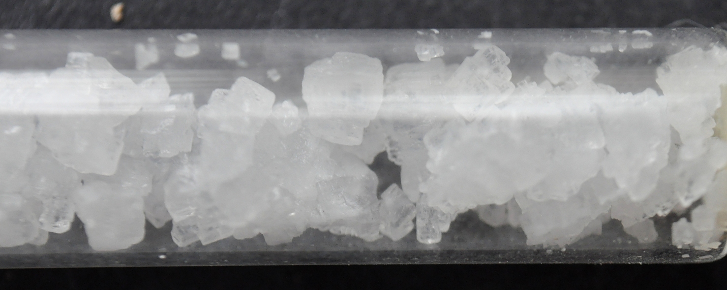
| ⓘ Halite Formula: NaCl |
Gallery:

List of minerals arranged by Strunz 10th Edition classification
| Group 3 - Halides | |||
|---|---|---|---|
| ⓘ | Halite | 3.AA.20 | NaCl |
| ⓘ | Antarcticite | 3.BB.30 | CaCl2 · 6H2O |
| Group 5 - Nitrates and Carbonates | |||
| ⓘ | Calcite | 5.AB.05 | CaCO3 |
| Group 7 - Sulphates, Chromates, Molybdates and Tungstates | |||
| ⓘ | Anhydrite | 7.AD.30 | CaSO4 |
| ⓘ | Celestine | 7.AD.35 | SrSO4 |
| ⓘ | Gypsum | 7.CD.40 | CaSO4 · 2H2O |
List of minerals for each chemical element
| H | Hydrogen | |
|---|---|---|
| H | ⓘ Antarcticite | CaCl2 · 6H2O |
| H | ⓘ Gypsum | CaSO4 · 2H2O |
| C | Carbon | |
| C | ⓘ Calcite | CaCO3 |
| O | Oxygen | |
| O | ⓘ Anhydrite | CaSO4 |
| O | ⓘ Antarcticite | CaCl2 · 6H2O |
| O | ⓘ Calcite | CaCO3 |
| O | ⓘ Celestine | SrSO4 |
| O | ⓘ Gypsum | CaSO4 · 2H2O |
| Na | Sodium | |
| Na | ⓘ Halite | NaCl |
| S | Sulfur | |
| S | ⓘ Anhydrite | CaSO4 |
| S | ⓘ Celestine | SrSO4 |
| S | ⓘ Gypsum | CaSO4 · 2H2O |
| Cl | Chlorine | |
| Cl | ⓘ Antarcticite | CaCl2 · 6H2O |
| Cl | ⓘ Halite | NaCl |
| Ca | Calcium | |
| Ca | ⓘ Anhydrite | CaSO4 |
| Ca | ⓘ Antarcticite | CaCl2 · 6H2O |
| Ca | ⓘ Calcite | CaCO3 |
| Ca | ⓘ Gypsum | CaSO4 · 2H2O |
| Sr | Strontium | |
| Sr | ⓘ Celestine | SrSO4 |
Other Databases
| Link to USGS MRDS: | 10262540 |
|---|
Other Regions, Features and Areas containing this locality
North AmericaContinent
North America PlateTectonic Plate
- Basin and Range BasinsBasin
- Mojave DomainDomain
- Southern Basin and RangeWide Rift
USA
- Mojave DesertDesert
This page contains all mineral locality references listed on mindat.org. This does not claim to be a complete list. If you know of more minerals from this site, please register so you can add to our database. This locality information is for reference purposes only. You should never attempt to
visit any sites listed in mindat.org without first ensuring that you have the permission of the land and/or mineral rights holders
for access and that you are aware of all safety precautions necessary.
References
Foshag, William Frederick (1926), Saline Lakes of the Mojave Region, Economic Geology: 21(1): 56-64.
Hewett, D. F.; Callaghan, Eugene; Moore, B. N.; Nolan, T. B.; Rubey, W. W.; Schaller, W. T. (1936) Mineral resources of the region around Boulder Dam. Bulletin 871. US Geological Survey doi:10.3133/b871
Ver Planck, Wm. E., Jr. (1952), Gypsum in California: California Division Mines Bulletin 163: 47-48.

Bristol Dry Lake pit [1], Saltus, San Bernardino County, California, USA