
Stargo Mine, Stargo, Greenlee County, Arizona, USAi
| Regional Level Types | |
|---|---|
| Stargo Mine | Mine |
| Stargo | Town (Historical) |
| Greenlee County | County |
| Arizona | State |
| USA | Country |
This page is currently not sponsored. Click here to sponsor this page.
Latitude & Longitude (WGS84):
33° 2' 59'' North , 109° 21' 33'' West
Latitude & Longitude (decimal):
Type:
Köppen climate type:
Other/historical names associated with this locality:
Capote Mine; Stargo Extension Mine; Stargo Silver Belt; Silverlead Mine; Silver King Mine; Silver Mohawk Mine; Nevada Mine; Craig Mine
A former surface and underground Ag-Au-Cu-Pb mine located on 26 patented claims totalling 520 acres in the E½SE¼ sec. 21 and the SW¼ sec. 22, T4S, R29E, on private land. Claims lie under the present town of Stargo. Central point in town of Stargo was used for UTM and geodetic location coordinates. Discovered by Ignacio Campbell in 1890. Produced 1907-1935. Former operators included the Stargo Silver Belt Mining Co.; the Stargo Syndicate; George W. Schale; Pedro Fuentes; Jose E. Tellez; Ignacio Campbell and Sons; The Stargo Mines Co. (Inc.); and the Detroit Copper Co. Owned and operated by the Phelps Dodge Corp., Morenci Branch.
Mineralization is a normal fissure vein filling with irregular and blanket lateral expansions, hosted in the Longfellow Limestone. The ore zone is 804.65 meters long, 15.24 meters wide and 6.1 meters thick, striking N-S and dipping 40W. Ore control was a N-S-trending fissure vein. Ore concentration was surface leaching and concentration of mineralizing solutions along bedding planes adjacent to the vein. Ore is in water-deposited quartz. Alteration was minor. The above describes the Stargo vein. There are 8 known veins on the Stargo proeprty of which the Stargo vein is the main deposit. The above describes the Stargo vein deposit. Maximum length data describes the surface exposure while the length underground may exceed 1.0 mile. All veins are similar in character and content. The Stargo property fissure system is located next to the Morenci quartz-monzonite porphyry area.
Area structures include a tilted block of limestone resting on basal quartzite and granite. The block is bounded by the Copper Mountain Fault to the NE and Apache Gulch (Stargo Gulch) to the SW. N-S-trending fissures cut by short cross-faults.
Tectonic component is the transition zone between the Basin and Range and Colorado Plateau Provinces and a fault block south of Morenci.
Workings totaled 411.48 meters long and 60.96 meters deep. Workings include hoists with maximum height of 150 feet, 3 working shafts, and a 75 ton capacity cyanide mill. Extensive surface mining occurred on the Stargo vein. Extensive surface mining was also undertaken along the Triangle, Capote, and Craig veins.
Select Mineral List Type
Standard Detailed Gallery Strunz Chemical ElementsDetailed Mineral List:
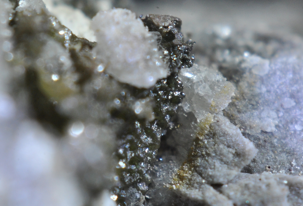
| ⓘ Bromargyrite Formula: AgBr Habit: Micro-crystals |
| ⓘ Native Silver Formula: Ag |
Gallery:
List of minerals arranged by Strunz 10th Edition classification
| Group 1 - Elements | |||
|---|---|---|---|
| ⓘ | Native Silver | 1.AA.05 | Ag |
| Group 3 - Halides | |||
| ⓘ | Bromargyrite | 3.AA.15 | AgBr |
List of minerals for each chemical element
| Br | Bromine | |
|---|---|---|
| Br | ⓘ Bromargyrite | AgBr |
| Ag | Silver | |
| Ag | ⓘ Bromargyrite | AgBr |
| Ag | ⓘ Native Silver | Ag |
Other Regions, Features and Areas containing this locality
North AmericaContinent
- Sonoran DesertDesert
North America PlateTectonic Plate
- Basin and Range BasinsBasin
- Mazatzal DomainDomain
- Southern Basin and RangeWide Rift
USA
- Arizona
- Greenlee County
- Copper Mountain Mining District (Clifton-Morenci Mining District)Mining District
- Shannon MountainsMountain Range
- Greenlee County
- Gila MountainsMountain Range
This page contains all mineral locality references listed on mindat.org. This does not claim to be a complete list. If you know of more minerals from this site, please register so you can add to our database. This locality information is for reference purposes only. You should never attempt to
visit any sites listed in mindat.org without first ensuring that you have the permission of the land and/or mineral rights holders
for access and that you are aware of all safety precautions necessary.
References
Weed, Walter Harvey (1922) Describing the Mining Companies of the World. The Mines Handbook - succeeding The Copper Handbook Vol. 15. The Mines Handbook Co. pp.454-455 - Stargo Mines Inc. and Stargo Silver Belt Mining Co.

Stargo Mine, Stargo, Greenlee County, Arizona, USA