
Královec quarry, Královec, Trutnov District, Hradec Králové Region, Czech Republici
| Regional Level Types | |
|---|---|
| Královec quarry | Quarry (Active) |
| Královec | Municipality |
| Trutnov District | District |
| Hradec Králové Region | Region |
| Czech Republic | Country |
This page is currently not sponsored. Click here to sponsor this page.



Latitude & Longitude (WGS84):
50° 39' 55'' North , 15° 59' 30'' East
Latitude & Longitude (decimal):
Type:
Quarry (Active) - last checked 2026
Age:
298.9 ± 0.15 to 252.17 ± 0.06 Ma
Geologic Time:
Köppen climate type:
Nearest Settlements:
| Place | Population | Distance |
|---|---|---|
| Královec | 169 (2018) | 1.8km |
| Lampertice | 454 (2018) | 2.9km |
| Bernartice | 902 (2018) | 2.9km |
| Lubawka | 6,404 (2015) | 4.4km |
| Žacléř | 3,613 (2018) | 5.7km |
Královec quarry (Czech: Lom Královec) is an active crushed-stone quarry near the village of Královec in the Trutnov District (Hradec Králové Region), Czech Republic, close to the Polish border. It works hard volcanic rock marketed as siliceous porphyry (křemitý porfyr) for crushed aggregate.
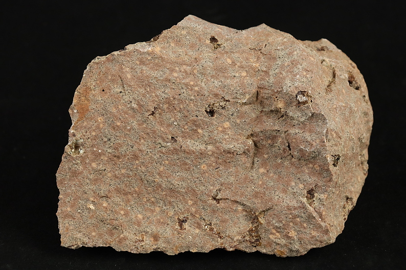
Geologically, the quarry is a well-known exposure of the Permo-Carboniferous volcanic succession of the Krkonoše Piedmont / Intrasudetic basin area. The main rock described from the quarry is a felsitic rhyolite / porphyritic rhyolite (often referred to locally as “porphyry”), and the Czech Geological Survey’s locality notes describe it as exposing part of an approximately 400 m-thick rhyolite body, with multiple colour/texture variants and numerous small joints/veins filled by quartz and potassium feldspar.
According to https://geopark.broumovsko.cz/geologicke-lokality/lom-kralovec "a marked hiking trail and cycle path pass in the immediate vicinity of the quarry along the access road and part of the working area with the movement of heavy machinery. Therefore, when visiting this publicly accessible area of the Královec quarry, it is necessary to be extra careful and not to enter the mining area of the quarry without permission."
Select Mineral List Type
Standard Detailed Gallery Strunz Chemical ElementsCommodity List
This is a list of exploitable or exploited mineral commodities recorded at this locality.Mineral List
1 valid mineral.
Rock Types Recorded
Note: data is currently VERY limited. Please bear with us while we work towards adding this information!
Select Rock List Type
Alphabetical List Tree DiagramDetailed Mineral List:
| ⓘ 'K Feldspar' References: https://lokality.geology.cz/3389?&la=en#Identification: Visual Identification |
| ⓘ Quartz Formula: SiO2 References: https://lokality.geology.cz/3389?&la=en#Identification: Visual Identification |
Gallery:
List of minerals arranged by Strunz 10th Edition classification
| Group 4 - Oxides and Hydroxides | |||
|---|---|---|---|
| ⓘ | Quartz | 4.DA.05 | SiO2 |
| Unclassified | |||
| ⓘ | 'K Feldspar' | - | |
Other Regions, Features and Areas containing this locality
CzechoslovakiaCountry
Eurasian PlateTectonic Plate
- Saxo-Thuringian BeltOrogenic Belt
EuropeContinent
- Bohemian MassifMassif
- SudetesMountain Range
- Central SudetesMountain Range
- SudetesMountain Range
Poland
- Lower Silesian Voivodeship
- Stone MountainsSupergroup (stratigraphic)
This page contains all mineral locality references listed on mindat.org. This does not claim to be a complete list. If you know of more minerals from this site, please register so you can add to our database. This locality information is for reference purposes only. You should never attempt to
visit any sites listed in mindat.org without first ensuring that you have the permission of the land and/or mineral rights holders
for access and that you are aware of all safety precautions necessary.

Královec quarry, Královec, Trutnov District, Hradec Králové Region, Czech Republic